
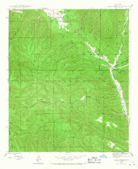
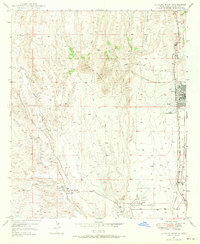
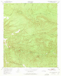
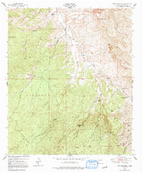
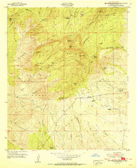
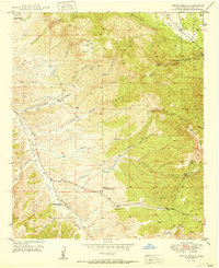
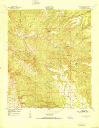
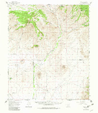
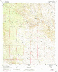
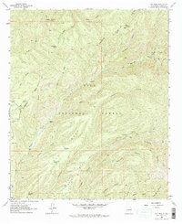
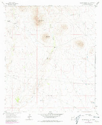
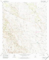
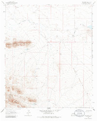
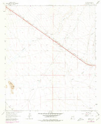
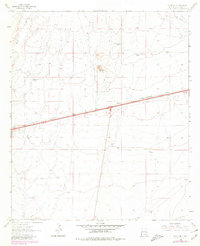
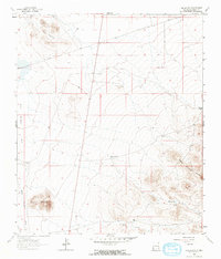
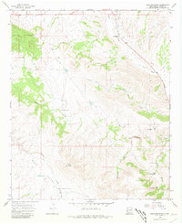
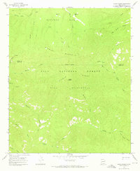
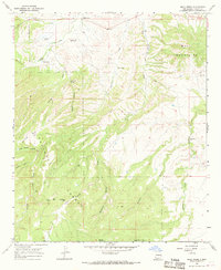
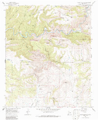
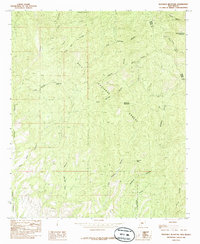
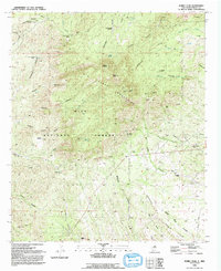
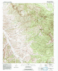
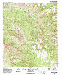
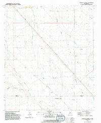
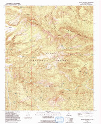
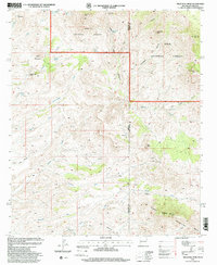
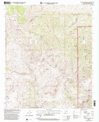
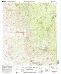
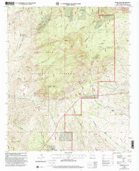
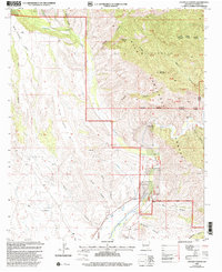
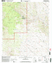
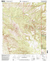
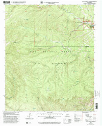
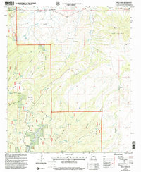
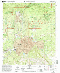
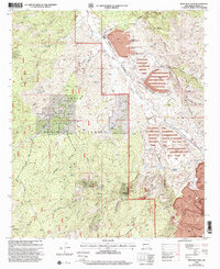
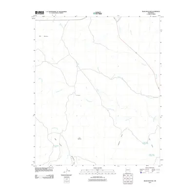
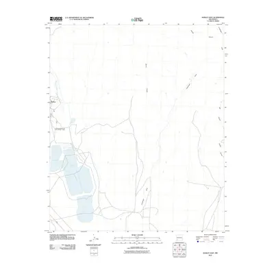
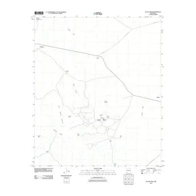
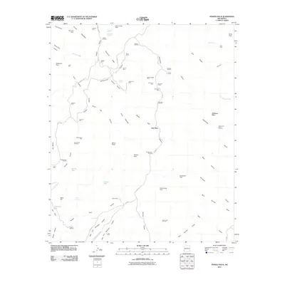
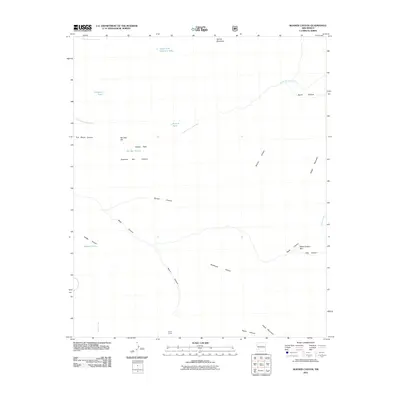
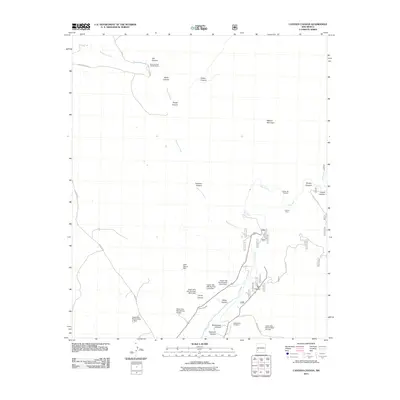
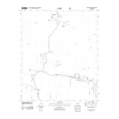
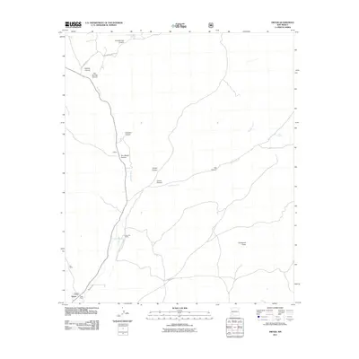
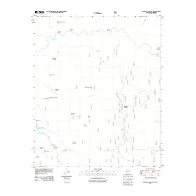
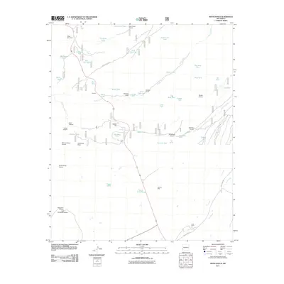
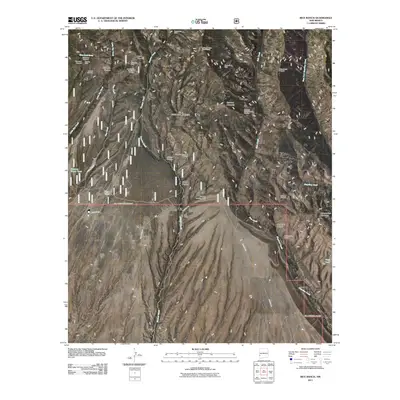
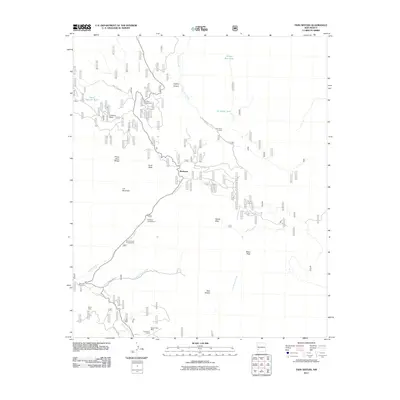
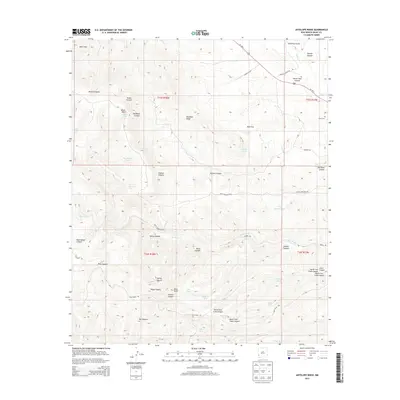
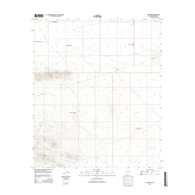
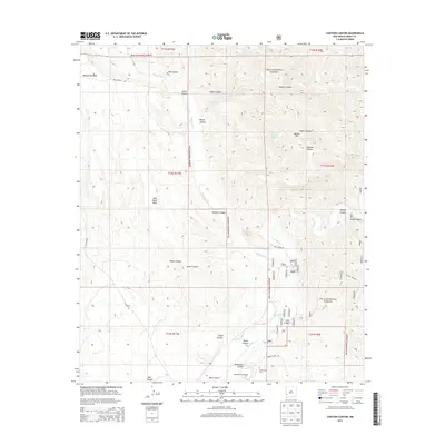
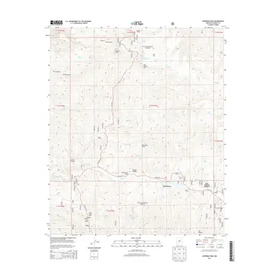
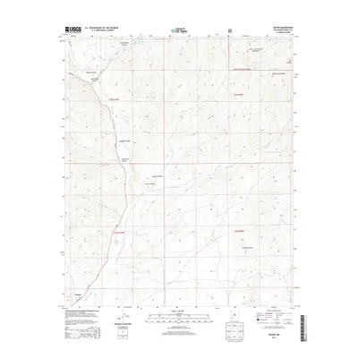
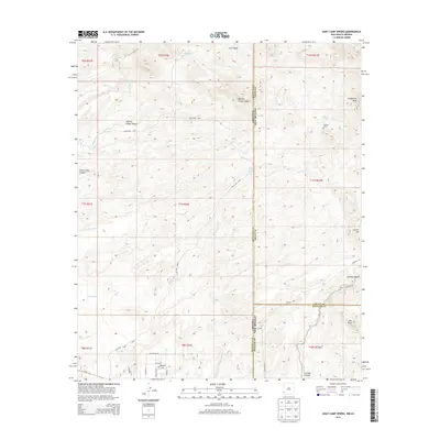
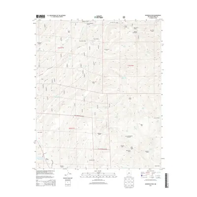
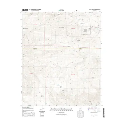
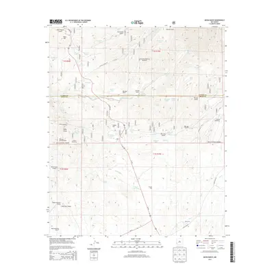
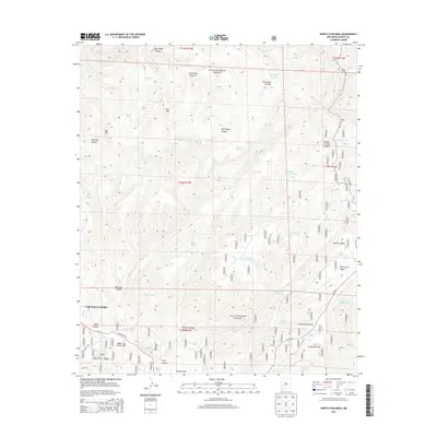
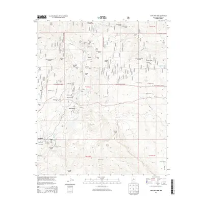
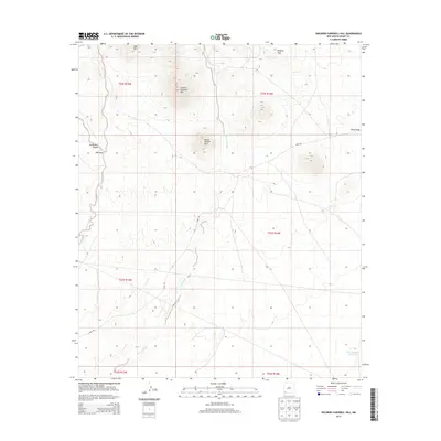
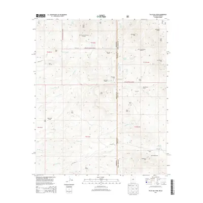
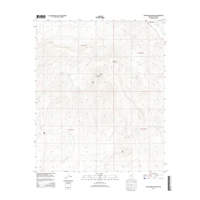
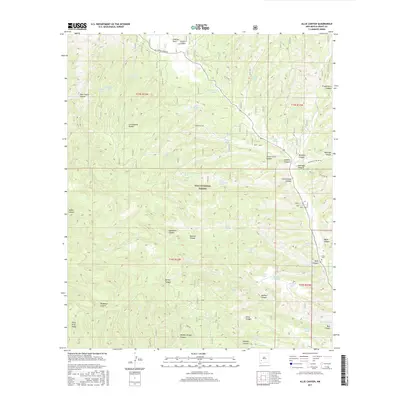
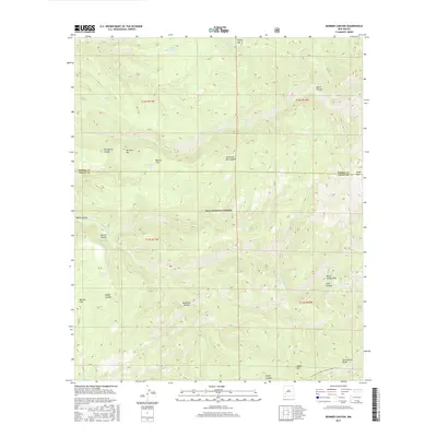
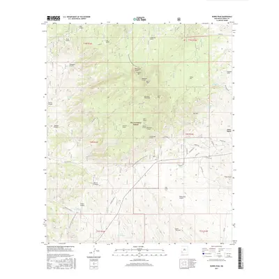
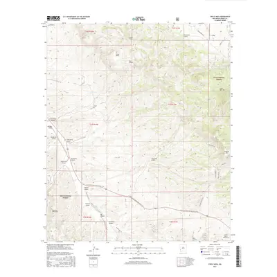
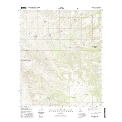
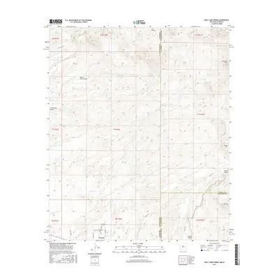
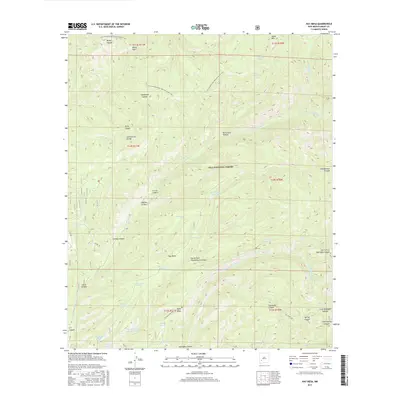
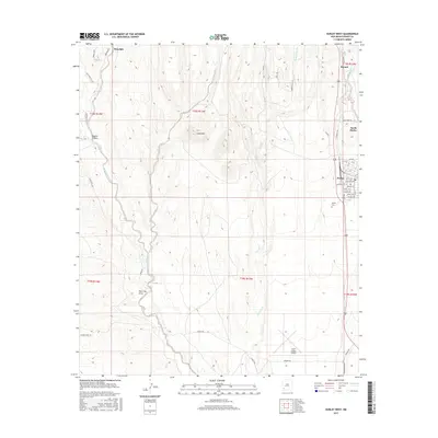
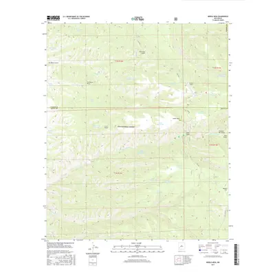
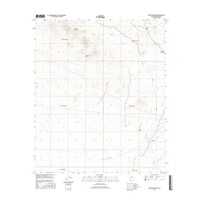
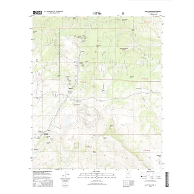
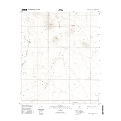
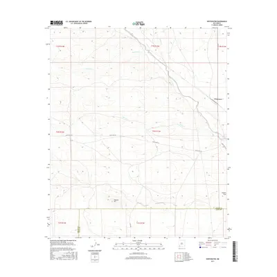
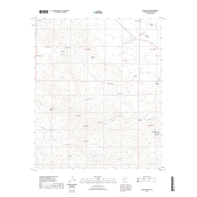
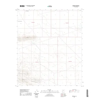
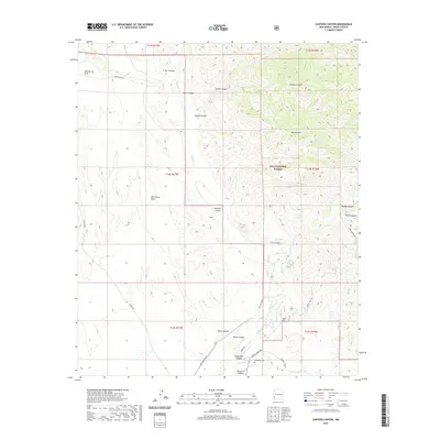
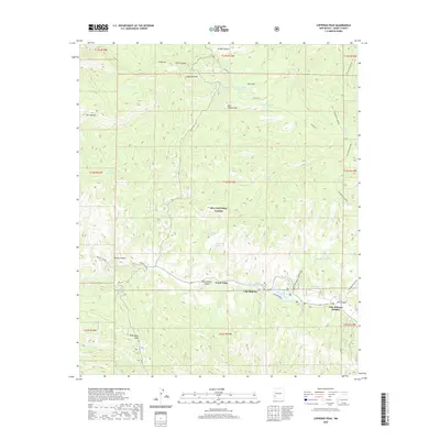
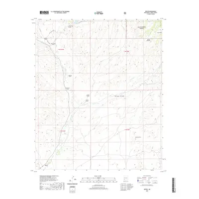
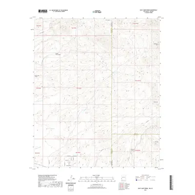
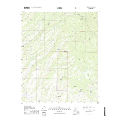
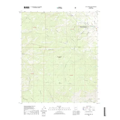
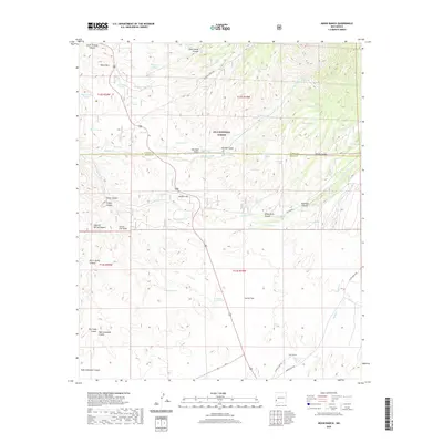
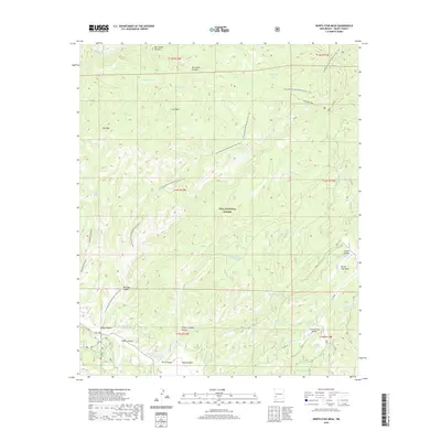
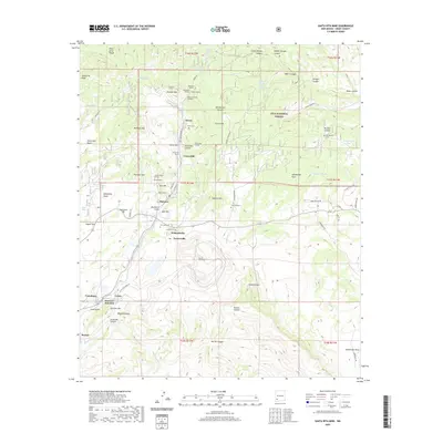
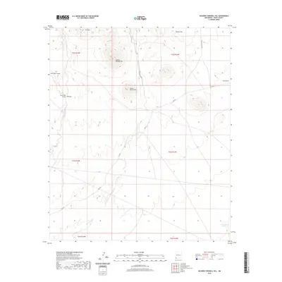
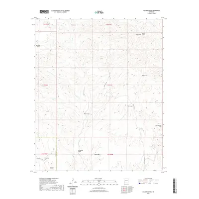
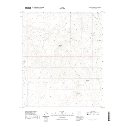
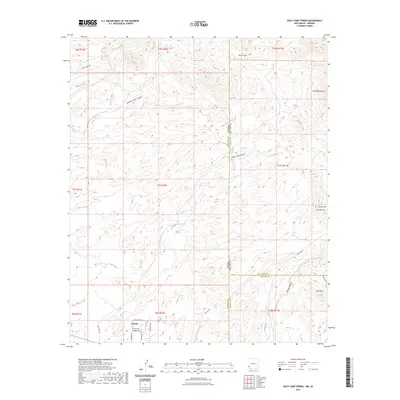
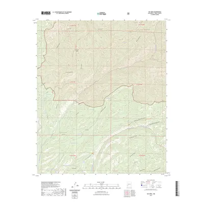
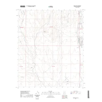
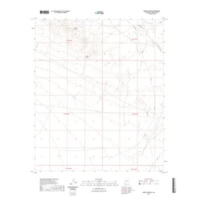
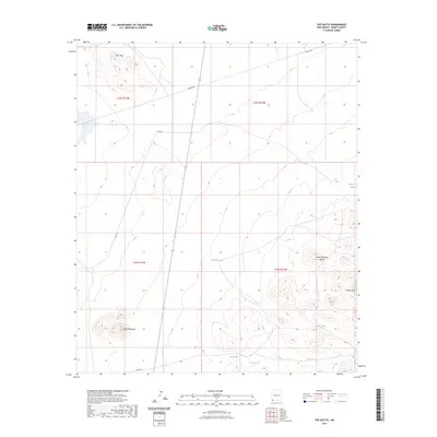
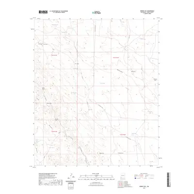
1986 Map of Goat Camp Spring
USGS Topo · Published 1987About this map
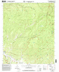
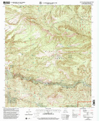
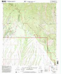
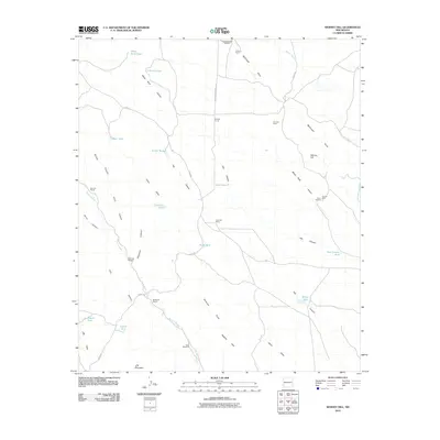
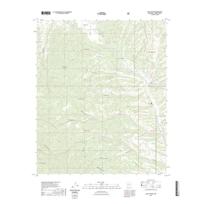
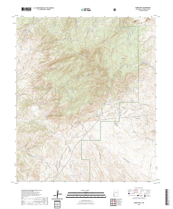
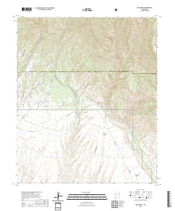
Hunter Flat and the edges of Duncan anchor the southwestern corner of this survey, where the desert floor meets the rising slopes of the Summit Mountains. The landscape is defined by its drainage systems and mining history, with numerous Mine and Mines symbols scattered through the complex canyon networks of Iron Canyon and Goat Camp Canyon. Strategic water sources like Goat Camp Spring and Mulberry Spring were essential for the small-scale operations and livestock grazing indicated by the Corrals found along Sand Wash.
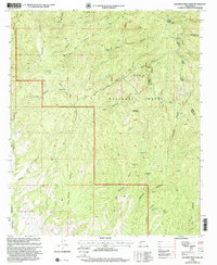
Find a feature on this map
28 named features on this map. Tap any name to fly to it.
Don’t see what you’re looking for? This feature index may not catch every label — zoom into the map to look around manually.
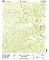
Map Details
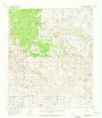
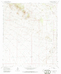
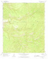
Editions of this 1986 Goat Camp Spring Map
This is the sole edition of this map. No revisions or reprints were ever made.
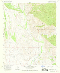
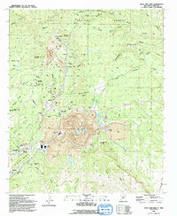
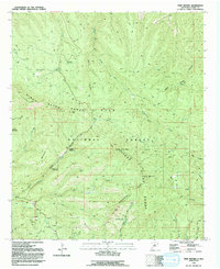
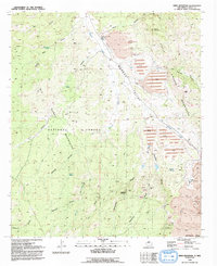
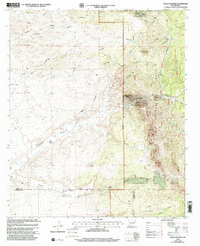
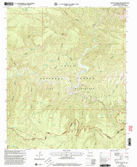
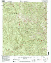
Historical Maps of Duncan Through Time
405 maps found

1937 Santa Rita
Grant County, NM
1947 Allie Canyon
Grant County, NM
1947 Faywood Station
Grant County, NM

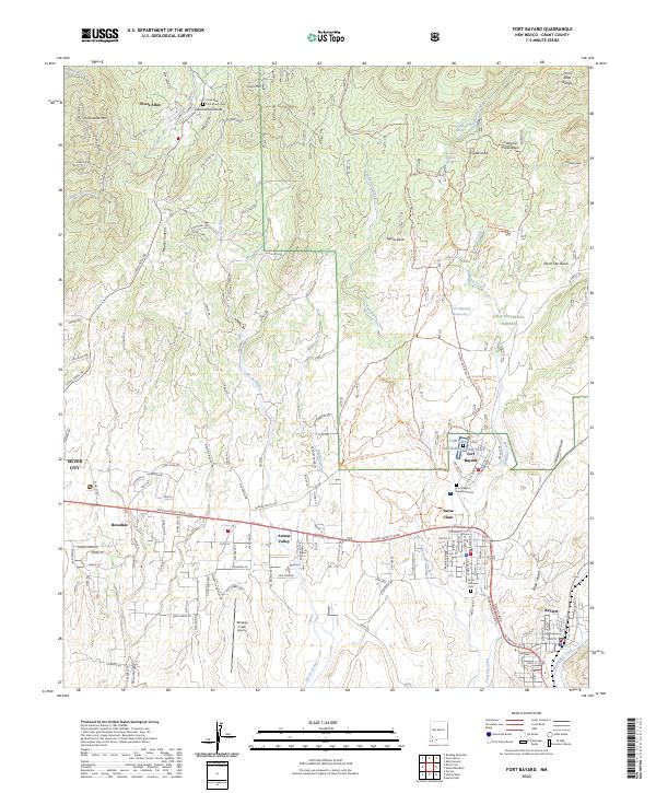
1947 Fort Bayard
Grant County, NM
1947 Twin Sisters
Grant County, NM

1948 Allie Canyon
Grant County, NM

1948 Hurley East
Grant County, NM

1948 Santa Rita
Grant County, NM

1948 Twin Sisters
Grant County, NM
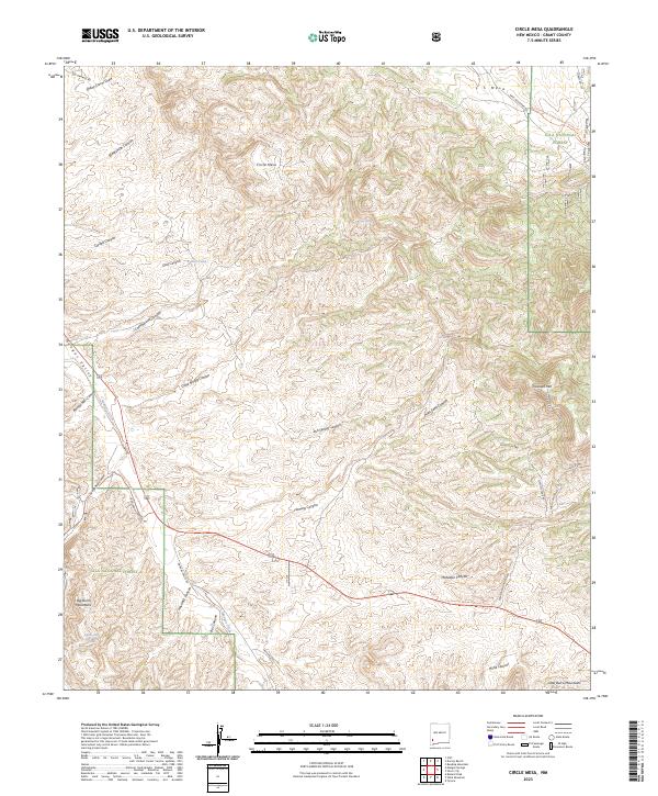
1949 Circle Mesa
Grant County, NM

1949 Faywood Station
Grant County, NM

1949 Fort Bayard
Grant County, NM

1949 Hurley East
Grant County, NM
1949 Hurley West
Grant County, NM
1949 Whitewater
Grant County, NM
1950 Burro Peak
Grant County, NM
1950 Dorsey Ranch
Grant County, NM
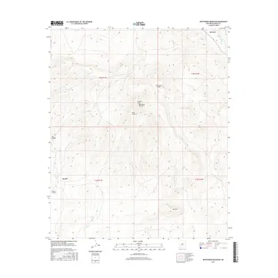
1950 Reading Mountain
Grant County, NM
1950 Wind Mountain
Grant County, NM
1951 Burro Peak
Grant County, NM
1951 Circle Mesa
Grant County, NM
1951 Dorsey Ranch
Grant County, NM
1951 Santa Rita
Grant County, NM
1951 Wind Mountain
Grant County, NM
1952 Reading Mountain
Grant County, NM
1956 Dwyer
Grant County, NM
1959 Steeple Rock
Grant County, NM
1962 Ninetysix Ranch
Grant County, NM
1963 Bonner Canyon
Grant County, NM
1963 C Bar Ranch
Grant County, NM
1963 Hay Mesa
Grant County, NM
1963 Soldiers Farewell Hill
Grant County, NM
1963 Werney Hill
Grant County, NM
1964 Brockman
Grant County, NM
1964 Separ
Grant County, NM
1964 Separ NE
Grant County, NM
1964 The Saltys
Grant County, NM
1965 Bear Mountain
Grant County, NM
1965 Canteen Canyon
Grant County, NM
1965 Canyon Hill
Grant County, NM
1965 Copperas Peak
Grant County, NM
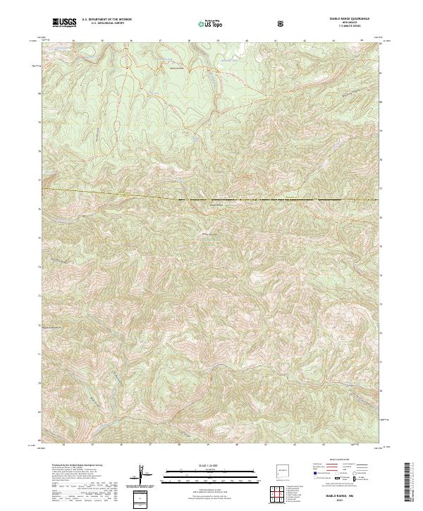
1965 Diablo Range
Grant County, NM
1965 Granny Mountain
Grant County, NM

1965 Little Turkey Park
Grant County, NM
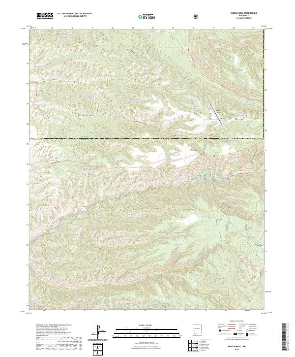
1965 Middle Mesa
Grant County, NM
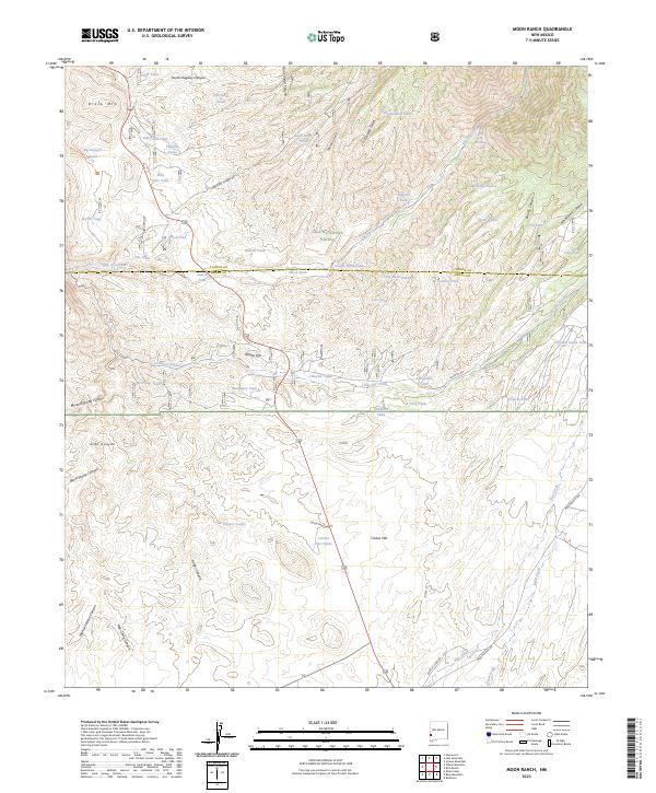
1965 Moon Ranch
Grant County, NM
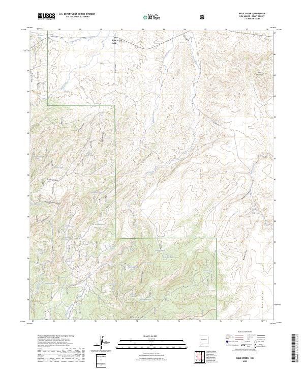
1965 Mule Creek
Grant County, NM
1965 North Star Mesa
Grant County, NM
1965 Rice Ranch
Grant County, NM
1965 Shelley Peak
Grant County, NM
1965 Wilson Mountain
Grant County, NM
1982 Playas Peak
Grant County, NM

1985 Dwyer
Grant County, NM
1985 Hendricks Peak
Grant County, NM
1985 Hillsboro Peak
Grant County, NM
1985 Maverick Mountain
Grant County, NM

1985 Taylor Mountain
Grant County, NM
1985 Whitehorse Mountain
Grant County, NM
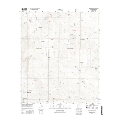
1986 Goat Camp Spring
Grant County, NM

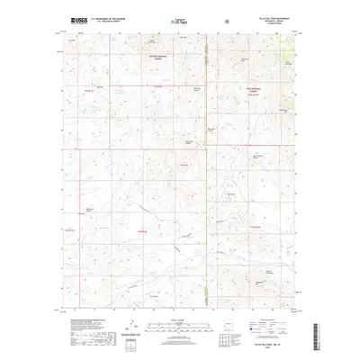
1986 Tillie Hall Peak
Grant County, NM

1989 Harden Cienega
Grant County, NM

1990 Antelope Ridge
Grant County, NM

1990 Applegate Mountain
Grant County, NM
1990 Brushy Mountain
Grant County, NM

1990 Bullard Peak
Grant County, NM

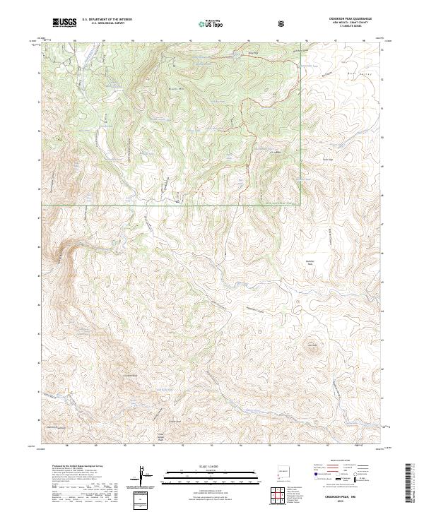
1990 Crookson Peak
Grant County, NM

1990 Eagle Eye Peak
Grant County, NM

1990 Mangas Springs
Grant County, NM

1990 Nichols Canyon
Grant County, NM

1990 Steeple Rock
Grant County, NM

1990 Walker Canyon
Grant County, NM
1992 Allie Canyon
Grant County, NM
1992 Burro Peak
Grant County, NM
1992 Circle Mesa
Grant County, NM
1992 Dorsey Ranch
Grant County, NM
1992 Faywood Station
Grant County, NM

1992 Fort Bayard
Grant County, NM

1992 Hurley East
Grant County, NM

1992 Hurley West
Grant County, NM
1992 Reading Mountain
Grant County, NM
1992 Santa Rita Mine
Grant County, NM
1992 Twin Sisters
Grant County, NM

1992 Whitewater
Grant County, NM
1992 Wind Mountain
Grant County, NM
1997 Tillie Hall Peak
Grant County, NM
1998 Harden Cienega
Grant County, NM
1999 Allie Canyon
Grant County, NM
1999 Bonner Canyon
Grant County, NM
1999 Brushy Mountain
Grant County, NM
1999 Bullard Peak
Grant County, NM
1999 Burro Peak
Grant County, NM
1999 Canteen Canyon
Grant County, NM

1999 Canyon Hill
Grant County, NM
1999 C Bar Ranch
Grant County, NM
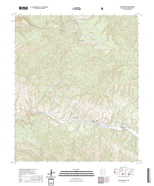
1999 Copperas Peak
Grant County, NM
1999 Crookson Peak
Grant County, NM
1999 Diablo Range
Grant County, NM
1999 Dorsey Ranch
Grant County, NM

1999 Dwyer
Grant County, NM
1999 Eagle Eye Peak
Grant County, NM

1999 Fort Bayard
Grant County, NM
1999 Granny Mountain
Grant County, NM

1999 Hay Mesa
Grant County, NM
1999 Hillsboro Peak
Grant County, NM
1999 Little Turkey Park
Grant County, NM

1999 Mangas Springs
Grant County, NM
1999 Maverick Mountain
Grant County, NM
1999 Middle Mesa
Grant County, NM
1999 Moon Ranch
Grant County, NM
1999 Mule Creek
Grant County, NM
1999 North Star Mesa
Grant County, NM
1999 Reading Mountain
Grant County, NM
1999 Rice Ranch
Grant County, NM
1999 Santa Rita Mine
Grant County, NM
1999 Shelley Peak
Grant County, NM
1999 Twin Sisters
Grant County, NM
1999 Wilson Mountain
Grant County, NM
1999 Wind Mountain
Grant County, NM

2005 Harden Cienega
Grant County, NM
2005 Tillie Hall Peak
Grant County, NM
2010 Antelope Ridge
Grant County, NM
2010 Applegate Mountain
Grant County, NM
2010 Bear Mountain
Grant County, NM
2010 Brockman
Grant County, NM
2010 Faywood Station
Grant County, NM
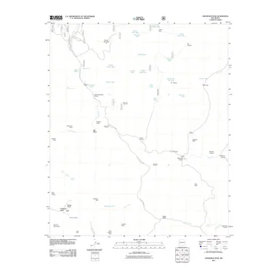
2010 Goat Camp Spring
Grant County, NM
2010 Hurley East
Grant County, NM
2010 Hurley West
Grant County, NM
2010 Nichols Canyon
Grant County, NM
2010 Ninetysix Ranch
Grant County, NM
2010 Playas Peak
Grant County, NM
2010 Separ
Grant County, NM
2010 Separ NE
Grant County, NM
2010 Soldiers Farewell Hill
Grant County, NM
2010 Steeple Rock
Grant County, NM
2010 Taylor Mountain
Grant County, NM
2010 The Saltys
Grant County, NM
2010 Walker Canyon
Grant County, NM
2010 Werney Hill
Grant County, NM
2010 Whitehorse Mountain
Grant County, NM
2010 Whitewater
Grant County, NM
2011 Allie Canyon
Grant County, NM
2011 Bonner Canyon
Grant County, NM
2011 Brushy Mountain
Grant County, NM
2011 Bullard Peak
Grant County, NM
2011 Burro Peak
Grant County, NM
2011 Canteen Canyon
Grant County, NM
2011 Canyon Hill
Grant County, NM
2011 C Bar Ranch
Grant County, NM
2011 Circle Mesa
Grant County, NM
2011 Copperas Peak
Grant County, NM
2011 Crookson Peak
Grant County, NM
2011 Diablo Range
Grant County, NM
2011 Dorsey Ranch
Grant County, NM
2011 Dwyer
Grant County, NM
2011 Eagle Eye Peak
Grant County, NM
2011 Fort Bayard
Grant County, NM
2011 Granny Mountain
Grant County, NM
2011 Harden Cienega
Grant County, NM
2011 Hay Mesa
Grant County, NM
2011 Hendricks Peak
Grant County, NM
2011 Hillsboro Peak
Grant County, NM
2011 Little Turkey Park
Grant County, NM
2011 Mangas Springs
Grant County, NM
2011 Maverick Mountain
Grant County, NM
2011 Middle Mesa
Grant County, NM
2011 Moon Ranch
Grant County, NM
2011 Mule Creek
Grant County, NM
2011 North Star Mesa
Grant County, NM
2011 Reading Mountain
Grant County, NM
2011 Rice Ranch
Grant County, NM
2011 Santa Rita Mine
Grant County, NM
2011 Shelley Peak
Grant County, NM
2011 Tillie Hall Peak
Grant County, NM
2011 Twin Sisters
Grant County, NM
2011 Wilson Mountain
Grant County, NM
2011 Wind Mountain
Grant County, NM
2013 Allie Canyon
Grant County, NM
2013 Antelope Ridge
Grant County, NM
2013 Applegate Mountain
Grant County, NM
2013 Bear Mountain
Grant County, NM
2013 Bonner Canyon
Grant County, NM
2013 Brockman
Grant County, NM
2013 Brushy Mountain
Grant County, NM
2013 Bullard Peak
Grant County, NM
2013 Burro Peak
Grant County, NM
2013 Canteen Canyon
Grant County, NM
2013 Canyon Hill
Grant County, NM
2013 C Bar Ranch
Grant County, NM
2013 Circle Mesa
Grant County, NM
2013 Copperas Peak
Grant County, NM
2013 Crookson Peak
Grant County, NM
2013 Diablo Range
Grant County, NM
2013 Dorsey Ranch
Grant County, NM
2013 Dwyer
Grant County, NM
2013 Eagle Eye Peak
Grant County, NM
2013 Faywood Station
Grant County, NM
2013 Fort Bayard
Grant County, NM
2013 Goat Camp Spring
Grant County, NM
2013 Granny Mountain
Grant County, NM
2013 Harden Cienega
Grant County, NM
2013 Hay Mesa
Grant County, NM
2013 Hendricks Peak
Grant County, NM
2013 Hillsboro Peak
Grant County, NM
2013 Hurley East
Grant County, NM
2013 Hurley West
Grant County, NM
2013 Little Turkey Park
Grant County, NM
2013 Mangas Springs
Grant County, NM
2013 Maverick Mountain
Grant County, NM
2013 Middle Mesa
Grant County, NM
2013 Moon Ranch
Grant County, NM
2013 Mule Creek
Grant County, NM
2013 Nichols Canyon
Grant County, NM
2013 Ninetysix Ranch
Grant County, NM
2013 North Star Mesa
Grant County, NM
2013 Playas Peak
Grant County, NM
2013 Reading Mountain
Grant County, NM
2013 Rice Ranch
Grant County, NM
2013 Santa Rita Mine
Grant County, NM
2013 Separ
Grant County, NM
2013 Separ NE
Grant County, NM
2013 Shelley Peak
Grant County, NM
2013 Soldiers Farewell Hill
Grant County, NM
2013 Steeple Rock
Grant County, NM
2013 Taylor Mountain
Grant County, NM
2013 The Saltys
Grant County, NM
2013 Tillie Hall Peak
Grant County, NM
2013 Twin Sisters
Grant County, NM
2013 Walker Canyon
Grant County, NM
2013 Werney Hill
Grant County, NM
2013 Whitehorse Mountain
Grant County, NM
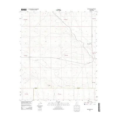
2013 Whitewater
Grant County, NM
2013 Wilson Mountain
Grant County, NM
2013 Wind Mountain
Grant County, NM
2017 Allie Canyon
Grant County, NM
2017 Antelope Ridge
Grant County, NM
2017 Applegate Mountain
Grant County, NM
2017 Bear Mountain
Grant County, NM
2017 Bonner Canyon
Grant County, NM
2017 Brockman
Grant County, NM
2017 Brushy Mountain
Grant County, NM
2017 Bullard Peak
Grant County, NM
2017 Burro Peak
Grant County, NM
2017 Canteen Canyon
Grant County, NM
2017 Canyon Hill
Grant County, NM
2017 C Bar Ranch
Grant County, NM
2017 Circle Mesa
Grant County, NM
2017 Copperas Peak
Grant County, NM
2017 Crookson Peak
Grant County, NM
2017 Diablo Range
Grant County, NM
2017 Dorsey Ranch
Grant County, NM
2017 Dwyer
Grant County, NM
2017 Eagle Eye Peak
Grant County, NM
2017 Faywood Station
Grant County, NM
2017 Fort Bayard
Grant County, NM
2017 Goat Camp Spring
Grant County, NM
2017 Granny Mountain
Grant County, NM
2017 Harden Cienega
Grant County, NM
2017 Hay Mesa
Grant County, NM
2017 Hendricks Peak
Grant County, NM
2017 Hillsboro Peak
Grant County, NM
2017 Hurley East
Grant County, NM
2017 Hurley West
Grant County, NM
2017 Little Turkey Park
Grant County, NM
2017 Mangas Springs
Grant County, NM
2017 Maverick Mountain
Grant County, NM
2017 Middle Mesa
Grant County, NM
2017 Moon Ranch
Grant County, NM
2017 Mule Creek
Grant County, NM
2017 Nichols Canyon
Grant County, NM
2017 Ninetysix Ranch
Grant County, NM
2017 North Star Mesa
Grant County, NM

2017 Playas Peak
Grant County, NM
2017 Reading Mountain
Grant County, NM
2017 Rice Ranch
Grant County, NM
2017 Santa Rita Mine
Grant County, NM
2017 Separ
Grant County, NM
2017 Separ NE
Grant County, NM
2017 Shelley Peak
Grant County, NM
2017 Soldiers Farewell Hill
Grant County, NM
2017 Steeple Rock
Grant County, NM
2017 Taylor Mountain
Grant County, NM
2017 The Saltys
Grant County, NM
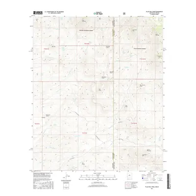
2017 Tillie Hall Peak
Grant County, NM

2017 Twin Sisters
Grant County, NM
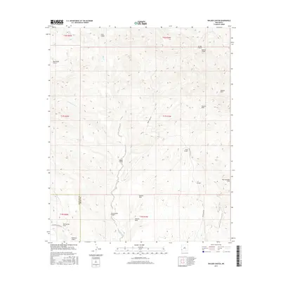
2017 Walker Canyon
Grant County, NM
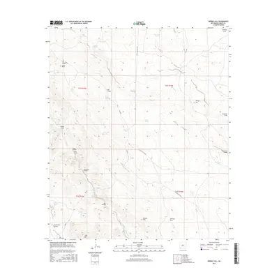
2017 Werney Hill
Grant County, NM
2017 Whitehorse Mountain
Grant County, NM
2017 Whitewater
Grant County, NM
2017 Wilson Mountain
Grant County, NM
2017 Wind Mountain
Grant County, NM
2020 Allie Canyon
Grant County, NM
2020 Antelope Ridge
Grant County, NM
2020 Applegate Mountain
Grant County, NM
2020 Bear Mountain
Grant County, NM
2020 Bonner Canyon
Grant County, NM
2020 Brockman
Grant County, NM
2020 Brushy Mountain
Grant County, NM
2020 Bullard Peak
Grant County, NM
2020 Burro Peak
Grant County, NM
2020 Canteen Canyon
Grant County, NM
2020 Canyon Hill
Grant County, NM
2020 C Bar Ranch
Grant County, NM
2020 Circle Mesa
Grant County, NM
2020 Copperas Peak
Grant County, NM
2020 Crookson Peak
Grant County, NM
2020 Diablo Range
Grant County, NM
2020 Dorsey Ranch
Grant County, NM
2020 Dwyer
Grant County, NM
2020 Eagle Eye Peak
Grant County, NM
2020 Faywood Station
Grant County, NM
2020 Fort Bayard
Grant County, NM
2020 Goat Camp Spring
Grant County, NM
2020 Granny Mountain
Grant County, NM
2020 Harden Cienega
Grant County, NM
2020 Hay Mesa
Grant County, NM
2020 Hendricks Peak
Grant County, NM
2020 Hillsboro Peak
Grant County, NM
2020 Hurley East
Grant County, NM
2020 Hurley West
Grant County, NM
2020 Little Turkey Park
Grant County, NM
2020 Mangas Springs
Grant County, NM
2020 Maverick Mountain
Grant County, NM
2020 Middle Mesa
Grant County, NM
2020 Moon Ranch
Grant County, NM
2020 Mule Creek
Grant County, NM
2020 Nichols Canyon
Grant County, NM
2020 Ninetysix Ranch
Grant County, NM
2020 North Star Mesa
Grant County, NM
2020 Playas Peak
Grant County, NM
2020 Reading Mountain
Grant County, NM
2020 Rice Ranch
Grant County, NM
2020 Santa Rita Mine
Grant County, NM
2020 Separ
Grant County, NM
2020 Separ NE
Grant County, NM
2020 Shelley Peak
Grant County, NM
2020 Soldiers Farewell Hill
Grant County, NM
2020 Steeple Rock
Grant County, NM
2020 Taylor Mountain
Grant County, NM
2020 The Saltys
Grant County, NM
2020 Tillie Hall Peak
Grant County, NM
2020 Twin Sisters
Grant County, NM
2020 Walker Canyon
Grant County, NM
2020 Werney Hill
Grant County, NM
2020 Whitehorse Mountain
Grant County, NM
2020 Whitewater
Grant County, NM
2020 Wilson Mountain
Grant County, NM
2020 Wind Mountain
Grant County, NM
2023 Allie Canyon
Grant County, NM
2023 Antelope Ridge
Grant County, NM
2023 Applegate Mountain
Grant County, NM
2023 Bear Mountain
Grant County, NM
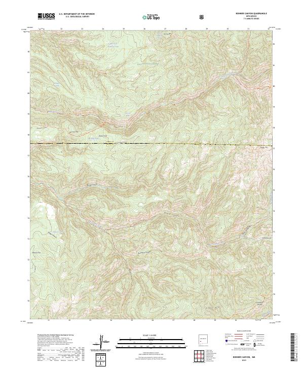
2023 Bonner Canyon
Grant County, NM
2023 Brockman
Grant County, NM
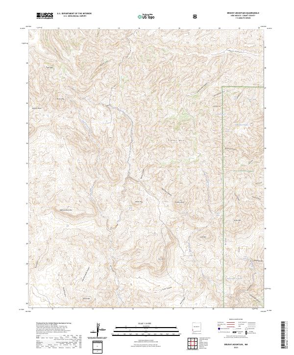
2023 Brushy Mountain
Grant County, NM
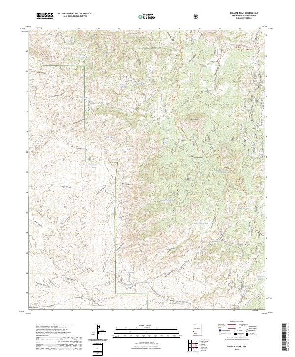
2023 Bullard Peak
Grant County, NM
2023 Burro Peak
Grant County, NM
2023 Canteen Canyon
Grant County, NM
2023 Canyon Hill
Grant County, NM
2023 C Bar Ranch
Grant County, NM
2023 Circle Mesa
Grant County, NM
2023 Copperas Peak
Grant County, NM
2023 Crookson Peak
Grant County, NM
2023 Diablo Range
Grant County, NM
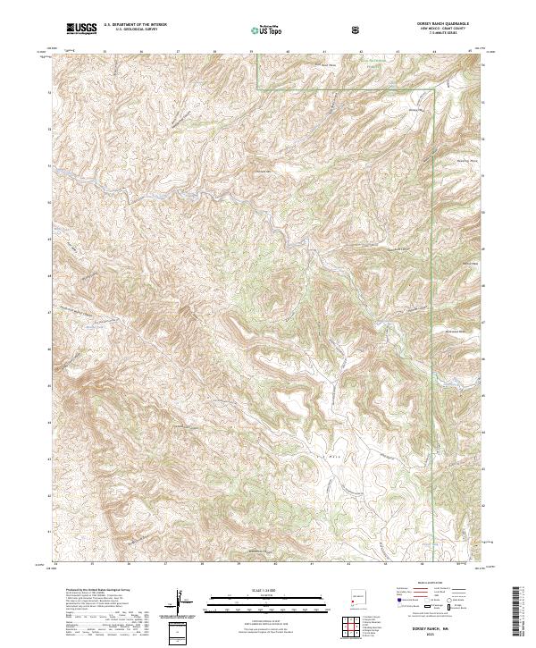
2023 Dorsey Ranch
Grant County, NM
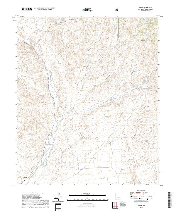
2023 Dwyer
Grant County, NM
2023 Eagle Eye Peak
Grant County, NM
2023 Faywood Station
Grant County, NM
2023 Fort Bayard
Grant County, NM
2023 Goat Camp Spring
Grant County, NM
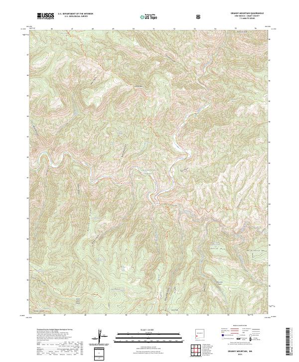
2023 Granny Mountain
Grant County, NM
2023 Harden Cienega
Grant County, NM
2023 Hay Mesa
Grant County, NM
2023 Hendricks Peak
Grant County, NM
2023 Hillsboro Peak
Grant County, NM
2023 Hurley East
Grant County, NM
2023 Hurley West
Grant County, NM
2023 Little Turkey Park
Grant County, NM
2023 Mangas Springs
Grant County, NM
2023 Maverick Mountain
Grant County, NM
2023 Middle Mesa
Grant County, NM
2023 Moon Ranch
Grant County, NM
2023 Mule Creek
Grant County, NM
2023 Nichols Canyon
Grant County, NM
2023 Ninetysix Ranch
Grant County, NM
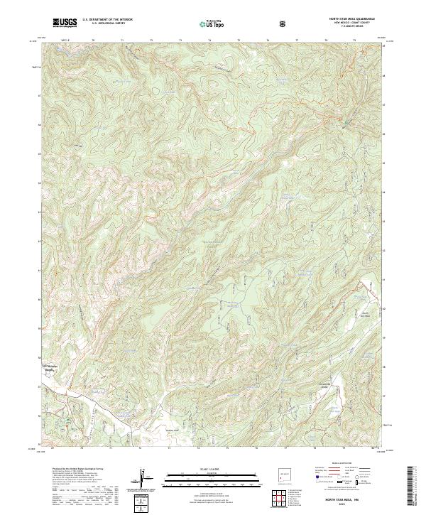
2023 North Star Mesa
Grant County, NM
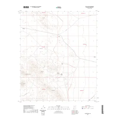
2023 Playas Peak
Grant County, NM
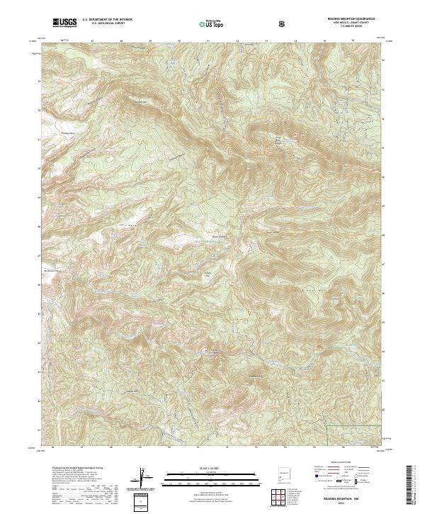
2023 Reading Mountain
Grant County, NM
2023 Rice Ranch
Grant County, NM
2023 Santa Rita Mine
Grant County, NM
2023 Separ
Grant County, NM
2023 Separ NE
Grant County, NM
2023 Shelley Peak
Grant County, NM
2023 Soldiers Farewell Hill
Grant County, NM
2023 Steeple Rock
Grant County, NM
2023 Taylor Mountain
Grant County, NM
2023 The Saltys
Grant County, NM
2023 Tillie Hall Peak
Grant County, NM
2023 Twin Sisters
Grant County, NM
2023 Walker Canyon
Grant County, NM
2023 Werney Hill
Grant County, NM
2023 Whitehorse Mountain
Grant County, NM
2023 Whitewater
Grant County, NM
2023 Wilson Mountain
Grant County, NM
2023 Wind Mountain
Grant County, NM