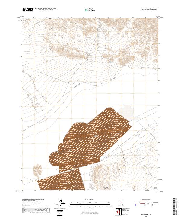
2021 Map of Goat Island
USGS Topo · Published 2021About this map
Clayton Valley dominates this desert landscape in Esmeralda County, showing the intricate industrial and natural topography of central Nevada's high basins. The map details a complex network of evaporation ponds and roads essential to the region's mineral extraction history, particularly concentrated around the southeastern edge of the valley. Local landmarks such as Goat Island and Angel Island emerge as distinct topographical rises above the level valley floor, while the Ralston Desert occupies the southeastern corner of the quadrangle. Transportation throughout this arid terrain relies on a few primary corridors, including Silverpeak Rd, which skirts the southern marshes, and the northern tracks of Weepah Rd and Paymaster Canyon Rd that lead into the surrounding hills.
Find a feature on this map
11 named features on this map. Tap any name to fly to it.
Don’t see what you’re looking for? This feature index may not catch every label — zoom into the map to look around manually.
Map Details
Editions of this 2021 Goat Island Map
This is the sole edition of this map. No revisions or reprints were ever made.
Other maps of this area

1898 · Silver Peak
USGS Topo · 1:125,000

1900 · Silver Peak
USGS Topo · 1:125,000

1908 · Lida
USGS Topo · 1:250,000

1913 · Lida
USGS Topo · 1:250,000

1945 · Goldfield
USGS Topo · 1:125,000

1954 · Goldfield
USGS Topo · 1:250,000

1955 · Goldfield
USGS Topo · 1:250,000

1958 · Goldfield
USGS Topo · 1:250,000

1962 · Goldfield
USGS Topo · 1:250,000

1963 · Silver Peak
USGS Topo · 1:62,500