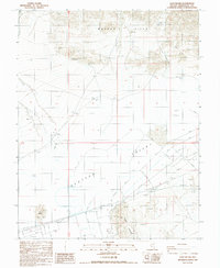
1987 Map of Goat Island
USGS Topo · Published 1987About this map
Clayton Valley dominates this 1980s landscape, revealing an industrial and mining-heavy environment in Esmeralda County. The desert floor is heavily modified with an extensive network of dikes, levees, and large evaporation ponds, signifying significant mineral extraction operations common to this part of Nevada. To the north, the Weepah Hills rise above the basin, scattered with evidence of prospecting and older activity including ruins and numerous prospects. Distinctive landforms such as Goat Island and Angel Island emerge from the valley floor, surrounded by complex water management infrastructure and a substation. The presence of a corral and several wells along private roads suggests the intersection of traditional land use with the larger-scale industrial modification of the salt flats.
Find a feature on this map
21 named features on this map. Tap any name to fly to it.
Don’t see what you’re looking for? This feature index may not catch every label — zoom into the map to look around manually.
Map Details
Editions of this 1987 Goat Island Map
This is the sole edition of this map. No revisions or reprints were ever made.
Other maps of this area

1898 · Silver Peak
USGS Topo · 1:125,000

1900 · Silver Peak
USGS Topo · 1:125,000

1908 · Lida
USGS Topo · 1:250,000

1913 · Lida
USGS Topo · 1:250,000

1945 · Goldfield
USGS Topo · 1:125,000

1954 · Goldfield
USGS Topo · 1:250,000

1955 · Goldfield
USGS Topo · 1:250,000

1958 · Goldfield
USGS Topo · 1:250,000

1962 · Goldfield
USGS Topo · 1:250,000

1963 · Silver Peak
USGS Topo · 1:62,500