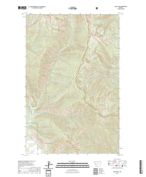
2024 Map of Goat Peak
USGS Topo · Published 2024About this map
Goat Peak stands as the literal and metaphorical high point of this high-altitude landscape along the border of Sanders and Lincoln Counties. The terrain is defined by the massive Cabinet Mountains Wilderness, where the Cabinet Mountains form a divide between the Kaniksu and Kootenai National Forests. The region is a network of ridges and deep drainage basins, characterized by numerous glacial tarns such as Wanless Lake and Baree Lake.
Find a feature on this map
47 named features on this map. Tap any name to fly to it.
Don’t see what you’re looking for? This feature index may not catch every label — zoom into the map to look around manually.
Map Details
Editions of this 2024 Goat Peak Map
This is the sole edition of this map. No revisions or reprints were ever made.
Other maps of this area

1920 · Libby
USGS Topo · 1:125,000

1920 · Jennings
USGS Topo · 1:125,000

1930 · Libby
USGS Topo · 1:125,000

1932 · Libby
USGS Topo · 1:125,000

1932 · Trout Creek
USGS Topo · 1:125,000

1935 · Thompson Lakes
USGS Topo · 1:96,000

1935 · Trout Creek
USGS Topo · 1:125,000

1936 · Trout Creek
USGS Topo · 1:125,000

1937 · Thompson Falls
USGS Topo · 1:125,000

1942 · Thompson Lakes
USGS Topo · 1:125,000