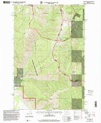
1997 Map of Goat Peak
USGS Topo · Published 2000About this map
The Cabinet Mountains Wilderness dominates this corner of Montana, where the boundary between Lincoln and Sanders counties follows the crest of high ridgelines. This landscape is defined by the steep elevation gains between drainages like Swamp Creek and the high summits of Goat Peak and Twenty Peak. The map reveals a complex network of forest management and early resource extraction, with the Kaniksu National Forest being administered by the Kootenai National Forest.
Find a feature on this map
36 named features on this map. Tap any name to fly to it.
Don’t see what you’re looking for? This feature index may not catch every label — zoom into the map to look around manually.
Map Details
Editions of this 1997 Goat Peak Map
This is the sole edition of this map. No revisions or reprints were ever made.
Other maps of this area

1920 · Libby
USGS Topo · 1:125,000

1920 · Jennings
USGS Topo · 1:125,000

1930 · Libby
USGS Topo · 1:125,000

1932 · Libby
USGS Topo · 1:125,000

1932 · Trout Creek
USGS Topo · 1:125,000

1935 · Thompson Lakes
USGS Topo · 1:96,000

1935 · Trout Creek
USGS Topo · 1:125,000

1936 · Trout Creek
USGS Topo · 1:125,000

1937 · Thompson Falls
USGS Topo · 1:125,000

1942 · Thompson Lakes
USGS Topo · 1:125,000