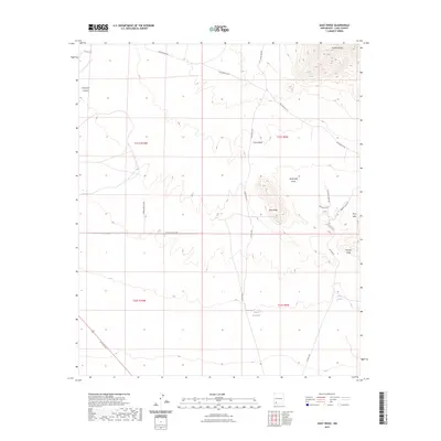
2023 Map of Goat Ridge
USGS Topo · Published 2023About this map
Butterfield Trl cuts across the high desert landscape of Luna County, tracing a historic passage through the Cookes Range and across the drainage of Butterfield Draw. This modern topographic study reveals a terrain of sharp elevation changes and natural catchment features like China Tank and the Wilson Reservoir. The presence of Williams Ranch and the network of local roads including Co RD a012 and N Gold Ave indicate the persistent ranching and mineral exploration history of the region. To the east, the prominent silhouettes of Fluorite Ridge and the Pony Hills rise from the valley floor, while deep incisions like Provinger Canyon and China Draw dominate the western and central portions of the quadrangle.
Find a feature on this map
24 named features on this map. Tap any name to fly to it.
Don’t see what you’re looking for? This feature index may not catch every label — zoom into the map to look around manually.
Map Details
Editions of this 2023 Goat Ridge Map
This is the sole edition of this map. No revisions or reprints were ever made.
Other maps of this area

1899 · Deming
USGS Topo · 1:125,000

1915 · Deming
USGS Topo · 1:125,000

1955 · Las Cruces
USGS Topo · 1:250,000

1956 · Dwyer
USGS Topo · 1:62,500

1958 · Las Cruces
USGS Topo · 1:250,000

1962 · Lake Valley
USGS Topo · 1:62,500

1964 · Goat Ridge
USGS Topo · 1:24,000
1964 · Spalding
USGS Topo · 1:24,000

1964 · Deming West
USGS Topo · 1:24,000

1964 · Massacre Peak
USGS Topo · 1:24,000