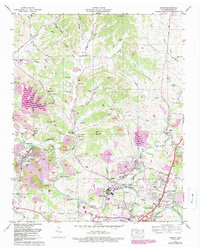
1965 Map of Godwin
USGS Topo · Published 1989About this map
Industrial land use and rural settlement patterns intersect along the northern reaches of the Duck River during this mid-century period. The landscape is notably marked by extensive extractive activity, with Strip Mine operations and Tailings Ponds concentrated near Monsanto Lake. This industrial presence contrasts with the dense network of traditional family and community markers, including numerous small burial grounds like Lasting Hope Cem and Ole Knob Creek Cem, which speak to the area's deep-rooted agrarian genealogy.
Find a feature on this map
86 named features on this map. Tap any name to fly to it.
Don’t see what you’re looking for? This feature index may not catch every label — zoom into the map to look around manually.
Map Details
Editions of this 1965 Godwin Map
3 editions found
Other maps of this area

1901 · Colombia
USGS Topo · 1:125,000

1909 · Franklin
USGS Topo · 1:62,500

1936 · Godwin
USGS Topo · 1:24,000

1936 · Williamsport
USGS Topo · 1:24,000

1936 · Primm
USGS Topo · 1:24,000

1936 · Spring Hill
USGS Topo · 1:24,000

1936 · Theta
USGS Topo · 1:24,000

1936 · Carters Creek
USGS Topo · 1:24,000

1936 · Mount Pleasant
USGS Topo · 1:24,000

1936 · Glendale
USGS Topo · 1:24,000