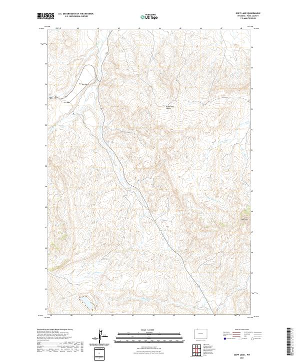
2021 Map of Goff Lake
USGS Topo · Published 2021About this map
Two Dot Flats and the surrounding high country of Park County define this landscape of the Bighorn Basin as it appeared in 2021. The map is dominated by the intricate drainage systems of Skull Cr, Pat O'Hara Cr, and Blaine Cr, which carve through the terrain and dictate the orientation of the few traversable routes like Crandall Rd. In the southeast, the slopes of Heart Mtn rise sharply, providing a significant geographical anchor for the region. This modern survey illustrates how topographic features continue to govern land use and travel in this sparsely populated area, with names like Little Sand Coulee and Alkali Cr Patch marking the distinct character of the arid basins and western forks that feed into the larger water system of Cottonwood Cr.
Find a feature on this map
15 named features on this map. Tap any name to fly to it.
Don’t see what you’re looking for? This feature index may not catch every label — zoom into the map to look around manually.
Map Details
Editions of this 2021 Goff Lake Map
This is the sole edition of this map. No revisions or reprints were ever made.
Other maps of this area

1949 · Pat O'Hara Mountain
USGS Topo · 1:62,500

1949 · Cody
USGS Topo · 1:62,500

1950 · Clark
USGS Topo · 1:62,500

1950 · Deep Lake
USGS Topo · 1:62,500

1951 · Cody
USGS Topo · 1:62,500

1955 · Cody
USGS Topo · 1:250,000

1958 · Cody
USGS Topo · 1:250,000

1962 · Cody
USGS Topo · 1:250,000

1980 · Cody
USGS Topo · 1:100,000
1987 · Cody
USGS Topo · 1:24,000