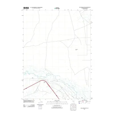
2011 Map of Golconda Butte
USGS Topo · Published 2011About this map
The Humboldt River carves a complex course through this corner of Nevada, defined by the winding channels of the Pioneer Slough. This modern survey documents a landscape of ranching and transit, where the C-S Ranch and the small settlement of Eglon sit along the river's path. To the north, the terrain rises toward the prominent landmark of Golconda Butte, while the valley floor is marked by low-lying features like The Island. The infrastructure of the Interstate 80 corridor is evident at Button Point and Bliss, showing the evolution of this historic travel route from its days as a pioneer trail to a major western thoroughfare. Local transit is further illustrated by names like Dutch Flat Rd and Marcus Dr, which provide access to the remote ranchlands and high desert terrain characteristic of the region.
Find a feature on this map
12 named features on this map. Tap any name to fly to it.
Don’t see what you’re looking for? This feature index may not catch every label — zoom into the map to look around manually.
Map Details
Editions of this 2011 Golconda Butte Map
This is the sole edition of this map. No revisions or reprints were ever made.
Other maps of this area

1882 · Paradise
USGS Topo · 1:250,000

1893 · Paradise
USGS Topo · 1:250,000

1932 · Sonoma Range
USGS Topo · 1:250,000

1939 · Sonoma Range
USGS Topo · 1:250,000

1945 · Osgood Mountains
USGS Topo · 1:62,500

1947 · Osgood Mountains
USGS Topo · 1:62,500

1955 · McDermitt
USGS Topo · 1:250,000

1955 · Winnemucca
USGS Topo · 1:250,000

1958 · Winnemucca
USGS Topo · 1:250,000

1958 · Winnemucca
USGS Topo · 1:62,500