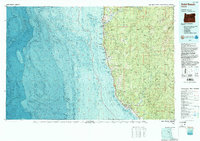
1993 Map of Gold Beach
USGS Topo · Published 1993About this map
Gold Beach and Wedderburn stand at the mouth of the Rogue River, serving as the primary coastal hubs along the 101 corridor during the early 1990s. This topographic-bathymetric study provides a rare combined view of the coastal shelf and the interior mountains, where the Pacific Ocean floor drops away near Goat Island while the land rises sharply into the Siskiyou National Forest. Further south, Brookings is situated near the mouth of the Chetco River, with the Winchuck River marking the landscape just before the state boundary.
Find a feature on this map
52 named features on this map. Tap any name to fly to it.
Don’t see what you’re looking for? This feature index may not catch every label — zoom into the map to look around manually.
Map Details
Editions of this 1993 Gold Beach Map
2 editions found
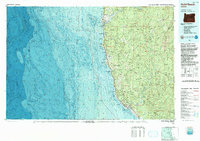
Other maps of this area

1899 · Port Orford
USGS Topo · 1:125,000

1903 · Port Orford
USGS Topo · 1:125,000

1917 · Kerby
USGS Topo · 1:125,000

1918 · Kerby
USGS Topo · 1:125,000

1922 · Preston Peak
USGS Topo · 1:125,000

1929 · Crescent City
USGS Topo · 1:125,000

1945 · Kerby
USGS Topo · 1:125,000

1945 · Gasquet
USGS Topo · 1:62,500

1945 · Point St. George
USGS Topo · 1:62,500

1948 · Weed
USGS Topo · 1:250,000