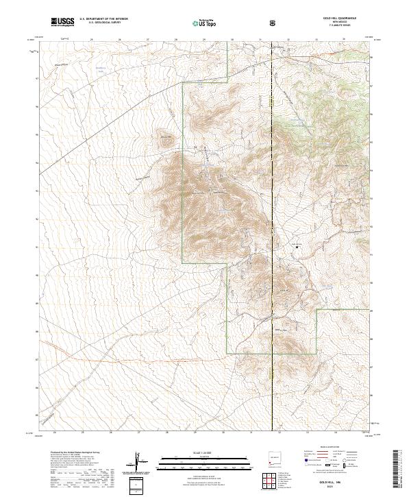
2023 Map of Gold Hill
USGS Topo · Published 2023About this map
Gold Hill rises as a prominent landmark in this high-elevation landscape along the border of Hidalgo and Grant counties. The terrain is defined by its water-management history, with numerous tanks such as Monarch Tank, Apache Tank, and Peterson Tank providing essential catchments for livestock and wildlife. These artificial features contrast with natural sources like Hoodoo Spring and Peterson Spring, illustrating the logistical challenges of ranching and survival in this arid environment.
Find a feature on this map
36 named features on this map. Tap any name to fly to it.
Don’t see what you’re looking for? This feature index may not catch every label — zoom into the map to look around manually.
Map Details
Editions of this 2023 Gold Hill Map
This is the sole edition of this map. No revisions or reprints were ever made.
Other maps of this area

1909 · Silver City
USGS Topo · 1:125,000

1950 · Burro Peak
USGS Topo · 1:24,000

1951 · Big Burro Mountains
USGS Topo · 1:24,000

1954 · Silver City
USGS Topo · 1:250,000

1958 · Silver City
USGS Topo · 1:250,000

1959 · Redrock
USGS Topo · 1:62,500

1962 · Silver City
USGS Topo · 1:250,000

1962 · Ninetysix Ranch
USGS Topo · 1:24,000

1962 · Lisbon
USGS Topo · 1:24,000

1963 · Lordsburg
USGS Topo · 1:24,000