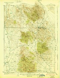
1928 Map of Gold Hill
USGS Topo · Published 1928About this map
Gold Hill stands as the primary hub of industrial activity in this high-desert mining district, surrounded by a concentration of claims including the Gold Hill Mine, Alvarado Mine, and Aube Mine. The landscape is dominated by the Deep Creek Mountains and Dutch Mountain, where the topography dictated the path of the historic Overland Trail as it moved through the region. Water sources were critical for both mining operations and ranching, evidenced by numerous named points like Goshute Spring, Wild Goose Spring, and Artesian Well. In the western valleys, the settlements of Ibapah and Clifton appear alongside family operations like Erickson Ranch and Sheridan Ranch, illustrating the transition from mineral extraction to agricultural life near the edge of the Great Salt Lake Desert. This 1920s survey records a moment when remote mining outposts and historical emigrant routes still defined the infrastructure of Tooele County.
Find a feature on this map
43 named features on this map. Tap any name to fly to it.
Don’t see what you’re looking for? This feature index may not catch every label — zoom into the map to look around manually.
Map Details
Editions of this 1928 Gold Hill Map
2 editions found
Other maps of this area

1908 · Fish Springs
USGS Topo · 1:250,000

1910 · Fish Springs
USGS Topo · 1:250,000

1925 · Gold Hill
USGS Topo · 1:62,500

1928 · Gold Hill
USGS Topo · 1:62,500

1953 · Tooele
USGS Topo · 1:250,000

1953 · Delta
USGS Topo · 1:250,000

1955 · Tooele
USGS Topo · 1:250,000

1955 · Elko
USGS Topo · 1:250,000

1956 · Ely
USGS Topo · 1:250,000

1958 · Elko
USGS Topo · 1:250,000