
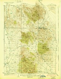
1928 Map of Gold Hill
USGS Topo · Published 1928About this map
Gold Hill stands as the primary industrial hub of this high-desert mining district, surrounded by a dense network of mineral claims and named shafts. The rugged geography of the Dutch Mountain and Deep Creek Mountains is punctuated by significant mining operations, including the Garrison Mine, Alvarado Mine, and the Rube Mine. This period of extraction is further evidenced by several U.S. Location Monuments scattered across the peaks, marking the legal framework of the early 20th-century mining boom.
Find a feature on this map
70 named features on this map. Tap any name to fly to it.
Don’t see what you’re looking for? This feature index may not catch every label — zoom into the map to look around manually.
Map Details
Editions of this 1928 Gold Hill Map
2 editions found
Other maps of this area

1908 · Fish Springs
USGS Topo · 1:250,000

1910 · Fish Springs
USGS Topo · 1:250,000

1925 · Gold Hill
USGS Topo · 1:62,500

1953 · Tooele
USGS Topo · 1:250,000

1953 · Delta
USGS Topo · 1:250,000

1955 · Tooele
USGS Topo · 1:250,000

1955 · Elko
USGS Topo · 1:250,000

1956 · Ely
USGS Topo · 1:250,000

1958 · Elko
USGS Topo · 1:250,000

1958 · Delta
USGS Topo · 1:250,000