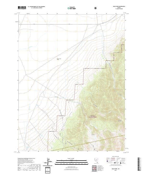
2021 Map of Gold Park
USGS Topo · Published 2021About this map
Gold Park sits at the base of the Shoshone Mountains in central Nevada, marking a point of intersection between the high desert floor and the steep wooded slopes of the Toiyabe National Forest. This 2021 survey illustrates the transition from the expansive Smith Creek Valley into the deeply incised drainages of War Eagle Canyon and Dry Canyon. The landscape is defined by its water sources, which dictated movement and settlement in this arid region, including Tule Spring and Peterson Spring, along with seasonal flows like Willow Cr and Antelope Cr. The map highlights several local thoroughfares, such as the Barrett Canyon War Eagle and Tule - War Eagle routes, which trace the historic paths through the canyons. The boundary between Lander Co and Nye Co cuts through the southern portion of the quadrangle, where the terrain reaches its highest elevations.
Find a feature on this map
22 named features on this map. Tap any name to fly to it.
Don’t see what you’re looking for? This feature index may not catch every label — zoom into the map to look around manually.
Map Details
Editions of this 2021 Gold Park Map
This is the sole edition of this map. No revisions or reprints were ever made.
Other maps of this area

1955 · Millett
USGS Topo · 1:250,000

1956 · South Shoshone Peak
USGS Topo · 1:62,500

1956 · North Shoshone Peak
USGS Topo · 1:62,500

1959 · Millett
USGS Topo · 1:250,000

1969 · Carroll Summit
USGS Topo · 1:24,000

1969 · Iron Mountain
USGS Topo · 1:24,000
1969 · Carroll Summit SE
USGS Topo · 1:24,000

1985 · Smith Creek Valley
USGS Topo · 1:100,000
1988 · Midas Spring
USGS Topo · 1:24,000
1988 · Campbell Creek Ranch
USGS Topo · 1:24,000