
1969 Map of Iron Mountain
USGS Topo · Published 1972About this map
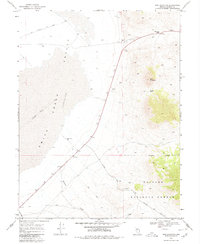
Old Overland Road traces the northern edge of this high-desert landscape in the late 1960s, cutting across the vast Smith Creek Valley. The terrain is defined by the sharp rise of the Toiyabe National Forest to the east, where the peaks of Iron Mountain and the ridge of Saddle Back dominate the skyline. This survey captures a remote working landscape characterized by sparse water sources like Brown Well and drainage via Birchim Creek. Human activity is marked by utility and transport, from the isolated Landing Strip on the valley floor to the various borrow pits and a network of jeep trails and the Elkhorn Road winding through the foothills. The presence of Railroad Pass at the northeast corner suggests a natural corridor used for transit through the mountainous divide.
Find a feature on this map
15 named features on this map. Tap any name to fly to it.
Don’t see what you’re looking for? This feature index may not catch every label — zoom into the map to look around manually.
Map Details
Editions of this 1969 Iron Mountain Map
2 editions found
Other maps of this area

1955 · Millett
USGS Topo · 1:250,000

1956 · South Shoshone Peak
USGS Topo · 1:62,500

1956 · North Shoshone Peak
USGS Topo · 1:62,500

1959 · Millett
USGS Topo · 1:250,000

1969 · Gandolfo Canyon
USGS Topo · 1:24,000

1969 · Emigrant Peak
USGS Topo · 1:24,000

1969 · Dutch Flat
USGS Topo · 1:24,000

1969 · Carroll Summit NE
USGS Topo · 1:24,000
1969 · Carroll Summit SE
USGS Topo · 1:24,000

1985 · Smith Creek Valley
USGS Topo · 1:100,000