
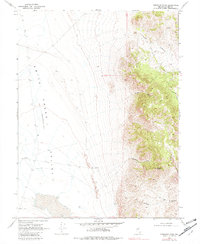
1969 Map of Emigrant Peak
USGS Topo · Published 1972About this map
Emigrant Peak stands as the primary landmark in this remote section of Lander County, overlooking a landscape defined by the dramatic descent into the Smith Creek Valley. The eastern portion of the map is dominated by a complex network of drainage systems, including Acree Canyon, Gandolfo Canyon, and Sand Canyon, which carve through the high terrain.
Find a feature on this map
13 named features on this map. Tap any name to fly to it.
Don’t see what you’re looking for? This feature index may not catch every label — zoom into the map to look around manually.
Map Details
Editions of this 1969 Emigrant Peak Map
2 editions found
Other maps of this area

1955 · Millett
USGS Topo · 1:250,000

1959 · Millett
USGS Topo · 1:250,000

1966 · Edwards Creek Valley
USGS Topo · 1:62,500

1969 · Mount Airy
USGS Topo · 1:24,000

1969 · Gandolfo Canyon
USGS Topo · 1:24,000

1969 · Mount Airy Mesa
USGS Topo · 1:24,000

1969 · Dutch Flat
USGS Topo · 1:24,000

1969 · Carroll Summit NE
USGS Topo · 1:24,000

1969 · Iron Mountain
USGS Topo · 1:24,000
1969 · Carroll Summit SE
USGS Topo · 1:24,000