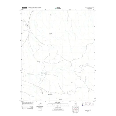
2011 Map of Gold Point
USGS Topo · Published 2011About this map
Gold Point anchors this portion of Esmeralda County, sitting near the base of high desert peaks. The landscape is defined by the drainages of Oriental Wash, which cuts through the arid terrain between Slate Ridge and Hanging Mesa. Settlement patterns here reflect the region's mining legacy, with isolated points like Tokop and Old Camp connected by a sparse network of dirt roads and tracks. At the southern edge of the survey, the Oriental Post Office and Causer Well Corral stand as markers of human activity near Gold Mountain. This 2011 edition by the U.S. Geological Survey captures the geography of this high-elevation basin, where elevations rise significantly toward Mount Dunfee and Lime Point, showing the enduring road systems used to navigate this corner of the Nevada desert.
Find a feature on this map
11 named features on this map. Tap any name to fly to it.
Don’t see what you’re looking for? This feature index may not catch every label — zoom into the map to look around manually.
Map Details
Editions of this 2011 Gold Point Map
This is the sole edition of this map. No revisions or reprints were ever made.
Other maps of this area

1908 · Lida
USGS Topo · 1:250,000

1913 · Lida
USGS Topo · 1:250,000

1954 · Goldfield
USGS Topo · 1:250,000

1955 · Goldfield
USGS Topo · 1:250,000

1957 · Ubehebe Crater
USGS Topo · 1:62,500

1958 · Goldfield
USGS Topo · 1:250,000

1962 · Goldfield
USGS Topo · 1:250,000

1968 · Lida
USGS Topo · 1:24,000

1968 · Stonewall Pass
USGS Topo · 1:24,000
1968 · Gold Point SW
USGS Topo · 1:24,000