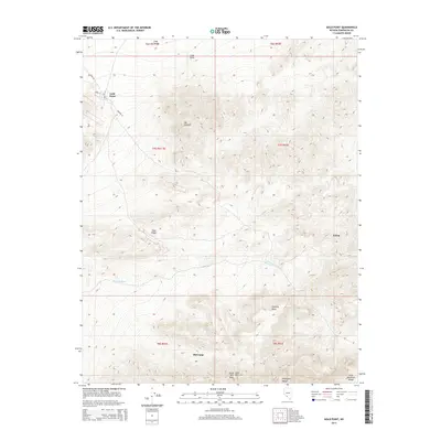
2014 Map of Gold Point
USGS Topo · Published 2014About this map
Gold Point serves as the focal point of this high-desert landscape in Esmeralda County, characterized by its grid of named streets including Horn St, Wiley Rd, and Orleans St. The terrain is dominated by prominent rises such as Mt Dunfee and Slate Ridge, which transition into the drainage of Oriental Wash to the south. Historically significant locations like Tokop and Old Camp are situated amongst the foothills of the Gold Mountain Range and the Amargosa Range. The map details a high-elevation environment where Gold Mtn Peak and Hanging Mesa overlook the Lida Valley to the north. This survey documents the intersection of legacy mining-era settlements and the natural topographical barriers of the Nevada desert.
Find a feature on this map
21 named features on this map. Tap any name to fly to it.
Don’t see what you’re looking for? This feature index may not catch every label — zoom into the map to look around manually.
Map Details
Editions of this 2014 Gold Point Map
This is the sole edition of this map. No revisions or reprints were ever made.
Other maps of this area

1908 · Lida
USGS Topo · 1:250,000

1913 · Lida
USGS Topo · 1:250,000

1954 · Goldfield
USGS Topo · 1:250,000

1955 · Goldfield
USGS Topo · 1:250,000

1957 · Ubehebe Crater
USGS Topo · 1:62,500

1958 · Goldfield
USGS Topo · 1:250,000

1962 · Goldfield
USGS Topo · 1:250,000

1968 · Lida
USGS Topo · 1:24,000

1968 · Stonewall Pass
USGS Topo · 1:24,000
1968 · Gold Point SW
USGS Topo · 1:24,000