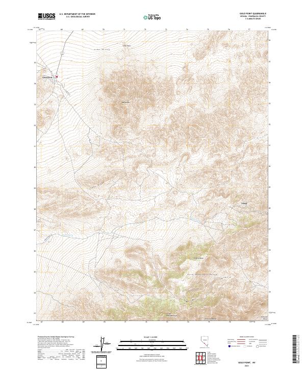
2021 Map of Gold Point
USGS Topo · Published 2021About this map
Gold Point anchors this high-desert landscape in the southwestern corner of Esmeralda County, reflecting a history tied to the mineral-rich mountains of the Basin and Range province. The settlement, situated at the intersection of 4th ST and Orleans ST, sits beneath the northern shadow of Slate Ridge. To the southeast, the terrain transitions into the Gold Mountain Range, where Gold Mtn Peak reaches into the Amargosa Range. This modern topographic study reveals the intricate drainage patterns of the Oriental Wash, which cuts a path toward the Lida Valley in the north. The presence of Tokop on the eastern edge of the quadrangle suggests a landscape where small outposts and mining prospects defined the distribution of local names and travel routes. From the heights of Mt Dunfee to the flat expanse of Hanging Mesa, the map documents the geographic isolation and extreme relief that characterize this pocket of Nevada.
Find a feature on this map
20 named features on this map. Tap any name to fly to it.
Don’t see what you’re looking for? This feature index may not catch every label — zoom into the map to look around manually.
Map Details
Editions of this 2021 Gold Point Map
This is the sole edition of this map. No revisions or reprints were ever made.
Other maps of this area

1908 · Lida
USGS Topo · 1:250,000

1913 · Lida
USGS Topo · 1:250,000

1954 · Goldfield
USGS Topo · 1:250,000

1955 · Goldfield
USGS Topo · 1:250,000

1957 · Ubehebe Crater
USGS Topo · 1:62,500

1958 · Goldfield
USGS Topo · 1:250,000

1962 · Goldfield
USGS Topo · 1:250,000

1968 · Lida
USGS Topo · 1:24,000

1968 · Stonewall Pass
USGS Topo · 1:24,000
1968 · Gold Point SW
USGS Topo · 1:24,000