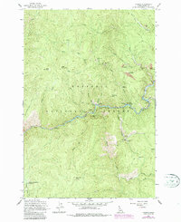
1962 Map of Golden
USGS Topo · Published 1987About this map
Golden sits along the canyon of the South Fork Clearwater River, serving as a central hub for the extensive gold mining operations within the Nezperce National Forest. This 1962 survey, updated with 1980s revisions, reveals a landscape defined by its mineral wealth, with numerous lode and placer operations scattered throughout the steep drainages. To the south, Old Golden and the Wonder Mine mark earlier centers of activity, while the northern slopes are dotted with sites like the Mackay Mine and Buffalo Idaho Mine. The presence of Meador Diggings and the Bluebird Placer Mine indicates a history of both subsurface and surface extraction. Beyond the industrial footprint, the map details high-elevation landmarks such as Nellie Mountain and Reed Mountain, alongside the remote Lower Twentymile Meadows and Rainy Day Point Campground, illustrating the transition from resource extraction to forest management and recreation.
Find a feature on this map
53 named features on this map. Tap any name to fly to it.
Don’t see what you’re looking for? This feature index may not catch every label — zoom into the map to look around manually.
Map Details
Editions of this 1962 Golden Map
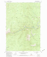
3 editions found
Other maps of this area

1931 · Buffalo Hump
USGS Topo · 1:125,000

1934 · Buffalo Hump
USGS Topo · 1:125,000

1956 · Elk City
USGS Topo · 1:250,000

1960 · Elk City
USGS Topo · 1:250,000

1962 · Golden
USGS Topo · 1:24,000

1962 · Center Star Mtn
USGS Topo · 1:24,000

1962 · Iron Mtn
USGS Topo · 1:24,000

1962 · Pilot Knob
USGS Topo · 1:24,000

1963 · Sourdough Peak
USGS Topo · 1:24,000

1963 · Huddleson Bluff
USGS Topo · 1:24,000