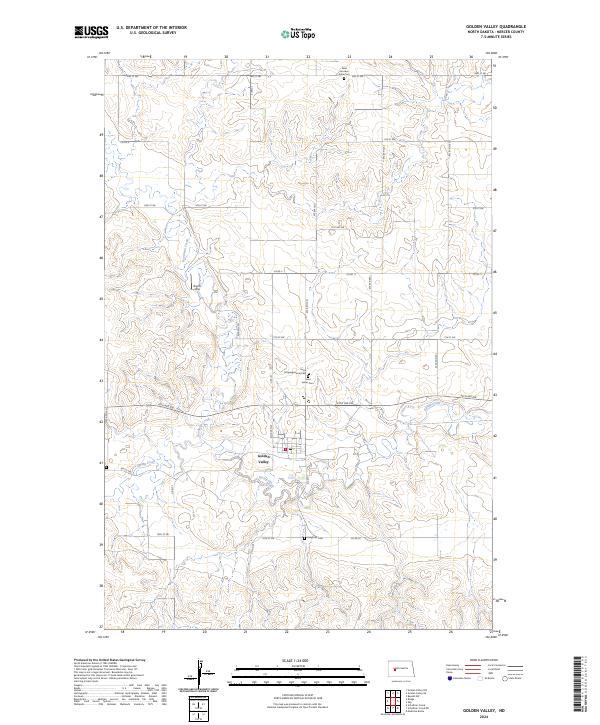
2024 Map of Golden Valley
USGS Topo · Published 2024About this map
Golden Valley serves as the central hub of this North Dakota landscape, situated at the confluence of several local routes in Mercer County. The settlement pattern is defined by a grid of section lines and rural roads like Co Rd 5 and Co Rd 20, which navigate the drainage basins of Spring Creek and Goodman Creek. This modern survey highlights a high density of burial sites for a rural area, including Saint Jacobus Sofia Cem in the north and Golgotha Cem to the south. These sites, along with Hope Congregational Cem and Saint James Cem, offer significant clues for genealogists and local historians tracing the community's ancestral roots and religious history. North of the town center, Brecht Strip adds a unique navigational or industrial landmark to the prairie terrain.
Find a feature on this map
39 named features on this map. Tap any name to fly to it.
Don’t see what you’re looking for? This feature index may not catch every label — zoom into the map to look around manually.
Map Details
Editions of this 2024 Golden Valley Map
This is the sole edition of this map. No revisions or reprints were ever made.
Other maps of this area

1953 · Watford City
USGS Topo · 1:250,000

1954 · McClusky
USGS Topo · 1:250,000

1957 · Watford City
USGS Topo · 1:250,000

1958 · McClusky
USGS Topo · 1:250,000

1967 · Watford City
USGS Topo · 1:250,000

1968 · Medicine Butte
USGS Topo · 1:24,000
1969 · Beulah NW
USGS Topo · 1:24,000

1969 · Zap
USGS Topo · 1:24,000
1970 · Golden Valley NE
USGS Topo · 1:24,000

1970 · Golden Valley NW
USGS Topo · 1:24,000