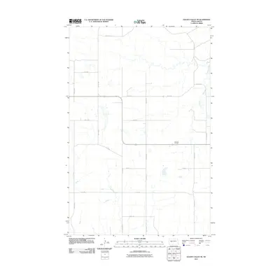
2011 Map of Golden Valley NE
USGS Topo · Published 2011About this map
Nayzatch Cemetery sits at the heart of this rural landscape, providing a primary point of reference for genealogists and local historians. The area is defined by the winding course of Beaver Creek, which cuts through the northeastern corner of the map, contrasting with the rigid section-line grid of the surrounding agricultural land. The transportation network is built upon a system of gravel and paved routes, including BIA Route 22 and numerous numbered county roads like County Rd-11 and County Rd-5. This grid-based development reflects the late-twentieth-century management of the North Dakota plains, where small settlements are connected by long-distance thoroughfares such as Main St and 1st St NW. The lack of large urban centers highlights the quiet, distributed nature of the homesteads and farms that make up this prairie region.
Find a feature on this map
17 named features on this map. Tap any name to fly to it.
Don’t see what you’re looking for? This feature index may not catch every label — zoom into the map to look around manually.
Map Details
Editions of this 2011 Golden Valley NE Map
This is the sole edition of this map. No revisions or reprints were ever made.
Other maps of this area

1953 · Watford City
USGS Topo · 1:250,000

1954 · McClusky
USGS Topo · 1:250,000

1957 · Watford City
USGS Topo · 1:250,000

1958 · McClusky
USGS Topo · 1:250,000

1967 · Watford City
USGS Topo · 1:250,000

1967 · Raub SE
USGS Topo · 1:24,000

1967 · Twin Buttes
USGS Topo · 1:24,000

1967 · Blackwater Lake SW
USGS Topo · 1:24,000
1969 · Beulah NW
USGS Topo · 1:24,000

1969 · Zap
USGS Topo · 1:24,000