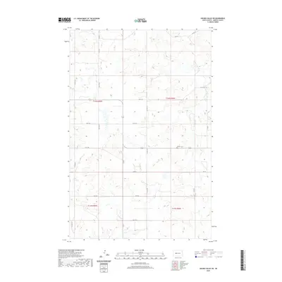
2020 Map of Golden Valley NE
USGS Topo · Published 2020About this map
Nayzatch Cem stands as a primary historical point of interest within this rural North Dakota landscape, situated near the intersection of section boundaries in the eastern portion of the survey. The terrain is defined by the drainage patterns of Beaver Cr, which cuts through the northeastern corner of the map. The local infrastructure follows a rigid section-line grid, dominated by a network of rural routes including Bia Rd 22, 71st Ave NW, and Co Rd 5. This 2020 layout reflects a largely agricultural and open territory, where the placement of small landmarks like Nayzatch Cem provides essential grounding for genealogists and local historians tracing family ties to the Mercer County area. The map captures a moment of modern continuity in a landscape that remains sparsely settled, yet precisely organized by township and range divisions.
Find a feature on this map
21 named features on this map. Tap any name to fly to it.
Don’t see what you’re looking for? This feature index may not catch every label — zoom into the map to look around manually.
Map Details
Editions of this 2020 Golden Valley NE Map
This is the sole edition of this map. No revisions or reprints were ever made.
Other maps of this area

1953 · Watford City
USGS Topo · 1:250,000

1954 · McClusky
USGS Topo · 1:250,000

1957 · Watford City
USGS Topo · 1:250,000

1958 · McClusky
USGS Topo · 1:250,000

1967 · Watford City
USGS Topo · 1:250,000

1967 · Raub SE
USGS Topo · 1:24,000

1967 · Twin Buttes
USGS Topo · 1:24,000

1967 · Blackwater Lake SW
USGS Topo · 1:24,000
1969 · Beulah NW
USGS Topo · 1:24,000

1969 · Zap
USGS Topo · 1:24,000