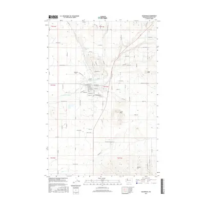
2017 Map of Goldendale
USGS Topo · Published 2017About this map
The Klickitat County seat of Goldendale serves as the central hub of this modern topographical study, situated where the high plateau meets the rising terrain of the Columbia Hills. The town's grid is clearly defined by historical corridors such as Railroad Ave and W Broadway St, reflecting its development as a regional center for agriculture and commerce. Beyond the residential and commercial core, the landscape is shaped by the seasonal flows of the Little Klickitat River and Bloodgood Creek, which trace the drainage patterns of the surrounding volcanic slopes.
Find a feature on this map
130 named features on this map. Tap any name to fly to it.
Don’t see what you’re looking for? This feature index may not catch every label — zoom into the map to look around manually.
Map Details
Editions of this 2017 Goldendale Map
This is the sole edition of this map. No revisions or reprints were ever made.
Other maps of this area

1953 · The Dalles
USGS Topo · 1:250,000

1956 · The Dalles
USGS Topo · 1:250,000

1957 · The Dalles
USGS Topo · 1:250,000

1957 · Wasco
USGS Topo · 1:62,500

1957 · Goldendale
USGS Topo · 1:62,500

1957 · Wishram
USGS Topo · 1:62,500

1957 · Satus Pass
USGS Topo · 1:62,500

1971 · Rufus
USGS Topo · 1:24,000
1977 · Wishram
USGS Topo · 1:24,000
1977 · Biggs Junction
USGS Topo · 1:24,000