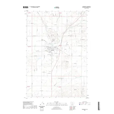
2020 Map of Goldendale
USGS Topo · Published 2020About this map
Goldendale serves as the central hub of this South-Central Washington landscape, where the grid of the town meets the winding course of the Little Klickitat River. The map captures a transition from the structured street plan—including W Broadway St and E Main St—to the surrounding agricultural and volcanic terrain. To the north, Bloodgood Cr and its namesake Bloodgood Spring feed the drainage basin, while the IOOF Mountain View Cem occupies a prominent position on the town's northern edge.
Find a feature on this map
92 named features on this map. Tap any name to fly to it.
Don’t see what you’re looking for? This feature index may not catch every label — zoom into the map to look around manually.
Map Details
Editions of this 2020 Goldendale Map
This is the sole edition of this map. No revisions or reprints were ever made.
Other maps of this area

1953 · The Dalles
USGS Topo · 1:250,000

1956 · The Dalles
USGS Topo · 1:250,000

1957 · The Dalles
USGS Topo · 1:250,000

1957 · Wasco
USGS Topo · 1:62,500

1957 · Goldendale
USGS Topo · 1:62,500

1957 · Wishram
USGS Topo · 1:62,500

1957 · Satus Pass
USGS Topo · 1:62,500

1971 · Rufus
USGS Topo · 1:24,000
1977 · Wishram
USGS Topo · 1:24,000
1977 · Biggs Junction
USGS Topo · 1:24,000