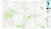
1985 Map of Goldfield
USGS Topo · Published 1985About this map
The high desert of Esmeralda County is anchored by the historic mining center of Goldfield, shown here during its late 20th-century status as a regional hub for the surrounding ranges. The landscape is defined by the Silver Peak Range and the Montezuma Range, where numerous extraction sites like the Mohawk Mine and Nivloc Mine trace the district's storied mineral heritage. In the arid basins between peaks, vital water sources such as Alkali Hot Spring and Post Hot Springs provided critical resources for the region's early development.
Find a feature on this map
72 named features on this map. Tap any name to fly to it.
Don’t see what you’re looking for? This feature index may not catch every label — zoom into the map to look around manually.
Map Details
Editions of this 1985 Goldfield Map
This is the sole edition of this map. No revisions or reprints were ever made.
Other maps of this area

1898 · Silver Peak
USGS Topo · 1:125,000

1900 · Silver Peak
USGS Topo · 1:125,000

1907 · Tonopah
USGS Topo · 1:250,000

1908 · Kawich
USGS Topo · 1:250,000

1908 · Lida
USGS Topo · 1:250,000

1908 · Tonopah
USGS Topo · 1:250,000

1909 · Hawthorne
USGS Topo · 1:250,000

1911 · Hawthorne
USGS Topo · 1:250,000

1913 · Bishop
USGS Topo · 1:125,000

1913 · Lida
USGS Topo · 1:250,000