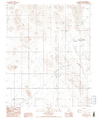
1986 Map of Goldstone
USGS Topo · Published 1986About this map
Fort Irwin Military Reservation and the U S Naval Reservation dominate this mid-1980s landscape in the Mojave Desert. The map reveals a specialized infrastructure centered around the Goldstone settlement and the nearby Mojave Base. This area is characterized by high-desert technical facilities, including a Radio Facility and Radio Tower, likely linked to deep space communications or military operations. To the east, the dry bed of Goldstone Lake sits adjacent to the Goldstone Landing Strip, indicating the site's importance for aerial access and logistical support. Numerous prospect markings and prospect pits are scattered throughout the high ground, particularly north of Superior Valley, where mining activity once probed the arid hills. The terrain is precisely measured against the San Bernardino Meridian, illustrating the intersection of natural desert features with strictly defined government jurisdictions.
Find a feature on this map
18 named features on this map. Tap any name to fly to it.
Don’t see what you’re looking for? This feature index may not catch every label — zoom into the map to look around manually.
Map Details
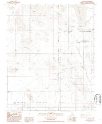
Editions of this 1986 Goldstone Map
2 editions found
Other maps of this area

1915 · Searles Lake
USGS Topo · 1:250,000

1933 · Avawatz Mountains
USGS Topo · 1:250,000

1947 · Trona
USGS Topo · 1:250,000

1948 · Trona
USGS Topo · 1:250,000

1948 · Lane Mountain
USGS Topo · 1:62,500

1948 · Goldstone Lake
USGS Topo · 1:62,500

1951 · Goldstone Lake
USGS Topo · 1:62,500

1951 · Lane Mountain
USGS Topo · 1:62,500

1953 · Trona
USGS Topo · 1:250,000

1954 · Pilot Knob
USGS Topo · 1:62,500