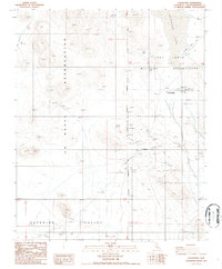
1986 Map of Goldstone
USGS Topo · Published 1988About this map
Fort Irwin Military Reservation and the Naval Weapons Center dominate this high desert landscape, highlighting the mid-1980s intersection of military operations and scientific infrastructure in San Bernardino County. The presence of the Mojave C Radio facility and the Mojave Base near the dry bed of Goldstone Lake underscores the area's role as a critical hub for deep space communications and military research.
Find a feature on this map
27 named features on this map. Tap any name to fly to it.
Don’t see what you’re looking for? This feature index may not catch every label — zoom into the map to look around manually.
Map Details
Editions of this 1986 Goldstone Map
2 editions found
Other maps of this area

1915 · Searles Lake
USGS Topo · 1:250,000

1933 · Avawatz Mountains
USGS Topo · 1:250,000

1947 · Trona
USGS Topo · 1:250,000

1948 · Trona
USGS Topo · 1:250,000

1948 · Lane Mountain
USGS Topo · 1:62,500

1948 · Goldstone Lake
USGS Topo · 1:62,500

1951 · Goldstone Lake
USGS Topo · 1:62,500

1951 · Lane Mountain
USGS Topo · 1:62,500

1953 · Trona
USGS Topo · 1:250,000

1954 · Pilot Knob
USGS Topo · 1:62,500