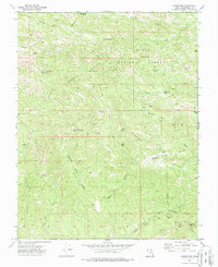
1972 Map of Goldstrike
USGS Topo · Published 1988About this map
Goldstrike and its surrounding mining claims anchor this 1970s survey of the Bull Valley Mountains region. The landscape is defined by its extractive history, with the Emma Mine situated on the slopes of Mineral Mountain and the Bull Run Mine located further south near Arsenic Gulch. These operations are connected by a network of steep Pack Trails and Jeep Trails that traverse the rugged high-desert terrain within the Dixie National Forest.
Find a feature on this map
38 named features on this map. Tap any name to fly to it.
Don’t see what you’re looking for? This feature index may not catch every label — zoom into the map to look around manually.
Map Details
Editions of this 1972 Goldstrike Map
3 editions found
Other maps of this area

1885 · St. George
USGS Topo · 1:250,000

1885 · Pioche
USGS Topo · 1:250,000

1886 · Pioche
USGS Topo · 1:250,000

1891 · St. George
USGS Topo · 1:250,000

1953 · Cedar City
USGS Topo · 1:250,000

1954 · Caliente
USGS Topo · 1:250,000

1954 · Gunlock
USGS Topo · 1:24,000

1958 · Cedar City
USGS Topo · 1:250,000

1958 · Docs Pass
USGS Topo · 1:24,000

1959 · Caliente
USGS Topo · 1:250,000