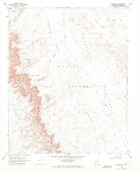
1969 Map of Goldtooth
USGS Topo · Published 1972About this map
Tohnali Mesa and the Moenkopi Plateau define the high-desert topography of this region within the Navajo Indian Reservation. Published in the late 1960s, the map documents a sparse landscape where water sources and transit routes dictate human movement. The settlement at Goldtooth sits at the base of the plateau, connected to the wider territory by a network of Jeep Trails and a Pack Trail that traverse the Adeii Eechii Cliffs.
Find a feature on this map
27 named features on this map. Tap any name to fly to it.
Don’t see what you’re looking for? This feature index may not catch every label — zoom into the map to look around manually.
Map Details
Editions of this 1969 Goldtooth Map
2 editions found
Other maps of this area

1886 · San Francisco Mtns
USGS Topo · 1:250,000

1886 · Echo Cliffs
USGS Topo · 1:250,000

1891 · San Francisco Mtns
USGS Topo · 1:250,000

1891 · Echo Cliffs
USGS Topo · 1:250,000

1894 · San Francisco Mtns
USGS Topo · 1:250,000

1899 · San Francisco Mtns
USGS Topo · 1:250,000

1947 · Flagstaff
USGS Topo · 1:250,000

1954 · Flagstaff
USGS Topo · 1:250,000
1955 · Cameron SE
USGS Topo · 1:24,000

1955 · Cameron
USGS Topo · 1:62,500