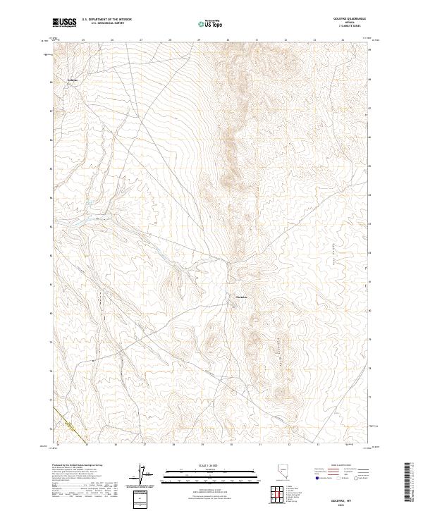
2021 Map of Goldyke
USGS Topo · Published 2021About this map
Goldyke and Pactolus occupy a corner of Nye County, where the desert landscape is defined by the elevation of the Pactolus Hills and the drainage of Antone Wash. This 2021 survey by the U.S. Geological Survey documents the remote terrain where Ione Valley meets the foothills. The presence of Stewart Spring suggests the vital importance of water sources in this arid region, while the utilitarian Poleline Rd cuts across the township boundaries of t10n r37e and t9n r37e. The map illustrates a high-desert environment where topography dictates movement, centered around these two named settlements. It captures the modern-day configuration of public lands and survey markers at the border of Nye and Mineral counties.
Find a feature on this map
14 named features on this map. Tap any name to fly to it.
Don’t see what you’re looking for? This feature index may not catch every label — zoom into the map to look around manually.
Map Details
Editions of this 2021 Goldyke Map
This is the sole edition of this map. No revisions or reprints were ever made.
Other maps of this area

1907 · Tonopah
USGS Topo · 1:250,000

1908 · Tonopah
USGS Topo · 1:250,000

1948 · Paradise Peak
USGS Topo · 1:62,500

1948 · Ione
USGS Topo · 1:62,500

1950 · Paradise Peak
USGS Topo · 1:62,500

1950 · Ione
USGS Topo · 1:62,500

1956 · Tonopah
USGS Topo · 1:250,000

1959 · Tonopah
USGS Topo · 1:250,000

1962 · Tonopah
USGS Topo · 1:250,000
1979 · Goldyke
USGS Topo · 1:24,000