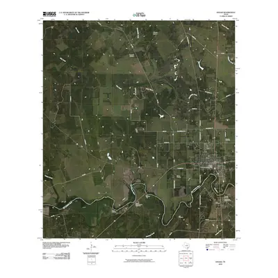
2010 Map of Goliad
USGS Topo · Published 2010About this map
Goliad serves as the focal point of this South Texas survey, situated where the San Antonio River carves a sharp turn at Horseshoe Bend. The town's deep heritage is represented by the Goliad County Courthouse Historic District and the colonial-era Presidio La Bahia and Mission Nuestra Senora del Rosario to the south. These landmarks, alongside numerous burial grounds such as Glendale Cemetery and Wisbey Cemetery, anchor the landscape in the early 21st century.
Find a feature on this map
50 named features on this map. Tap any name to fly to it.
Don’t see what you’re looking for? This feature index may not catch every label — zoom into the map to look around manually.
Map Details
Editions of this 2010 Goliad Map
This is the sole edition of this map. No revisions or reprints were ever made.
Other maps of this area

1953 · Beeville
USGS Topo · 1:250,000

1956 · Beeville
USGS Topo · 1:250,000

1960 · Beeville
USGS Topo · 1:250,000

1962 · Live Oak Lake
USGS Topo · 1:24,000

1962 · Melo
USGS Topo · 1:24,000

1962 · Hensley Lake
USGS Topo · 1:24,000

1962 · Goliad
USGS Topo · 1:24,000

1963 · Weesatche
USGS Topo · 1:24,000

1963 · Berclair
USGS Topo · 1:24,000
1963 · Runge SE
USGS Topo · 1:24,000