
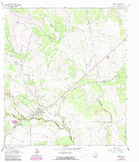
1963 Map of Berclair
USGS Topo · Published 1965About this map
The settlement of Berclair serves as the focal point for this South Texas landscape in the early 1960s, situated at the junction of the Southern Pacific railroad and a network of rural routes. The terrain is defined by the winding course of Blanco Creek and its various tributaries, including Millers Creek and Mucorrera Creek, which create a complex drainage pattern through the brush country. Scattered extractive activity is evident from numerous labels for Quarry and Quarries throughout the region.
Find a feature on this map
13 named features on this map. Tap any name to fly to it.
Don’t see what you’re looking for? This feature index may not catch every label — zoom into the map to look around manually.
Map Details
Editions of this 1963 Berclair Map
2 editions found
Other maps of this area

1953 · Beeville
USGS Topo · 1:250,000

1954 · Skidmore
USGS Topo · 1:62,500

1954 · Refugio
USGS Topo · 1:62,500

1956 · Beeville
USGS Topo · 1:250,000

1960 · Beeville
USGS Topo · 1:250,000

1962 · Melo
USGS Topo · 1:24,000

1962 · Goliad
USGS Topo · 1:24,000

1963 · Lazy F Ranch
USGS Topo · 1:24,000
1963 · Berclair NW
USGS Topo · 1:24,000
1963 · Charco
USGS Topo · 1:24,000