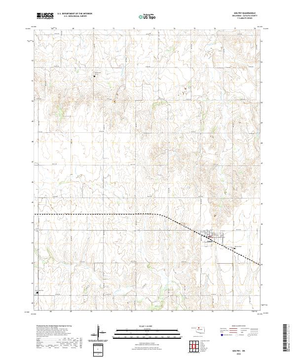
2022 Map of Goltry
USGS Topo · Published 2022About this map
Goltry serves as the central hub of this Alfalfa County landscape, where the local street grid is defined by Newell Ave and numbered thoroughfares from 5th St to 7th St. This area of Oklahoma is characterized by its organized section-line road system, including E0330 Rd and N2720 Rd, which navigate around the natural drainage of Turkey Cr and Wagon Cr. Genealogists will find significant local history preserved at several burial grounds dotting the township lines, notably the Karoma Cem just east of town, the Timberlake Cem to the northwest, and Good Hope Cem in the southwestern corner. The presence of a Po in the town center indicates its continued role as a focal point for the surrounding rural farming community.
Find a feature on this map
39 named features on this map. Tap any name to fly to it.
Don’t see what you’re looking for? This feature index may not catch every label — zoom into the map to look around manually.
Map Details
Editions of this 2022 Goltry Map
This is the sole edition of this map. No revisions or reprints were ever made.
Other maps of this area

1955 · Woodward
USGS Topo · 1:250,000

1956 · Ringwood
USGS Topo · 1:62,500

1958 · Woodward
USGS Topo · 1:250,000

1969 · Jet
USGS Topo · 1:24,000

1969 · Goltry
USGS Topo · 1:24,000

1969 · Fairview NE
USGS Topo · 1:24,000

1969 · Nash
USGS Topo · 1:24,000

1969 · Helena
USGS Topo · 1:24,000

1969 · Jet SE
USGS Topo · 1:24,000
1969 · Cherokee South
USGS Topo · 1:24,000