
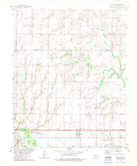
1969 Map of Fairview NE
USGS Topo · Published 1971About this map
Southeast Chaney Dell Oil Field dominates the central landscape of this Oklahoma survey, highlighting the active petroleum and natural gas extraction of the late 1960s. Scattered oil and gas wells are interspersed across a terrain defined by named areas such as Round Grove and Helena. This region, crossing the boundary between Alfalfa and Major counties, reveals a deeply rooted community infrastructure centered around rural crossroads and spiritual centers like Wildwood Ch and Missionary Ch.
Find a feature on this map
16 named features on this map. Tap any name to fly to it.
Don’t see what you’re looking for? This feature index may not catch every label — zoom into the map to look around manually.
Map Details
Editions of this 1969 Fairview NE Map
This is the sole edition of this map. No revisions or reprints were ever made.
Other maps of this area

1955 · Woodward
USGS Topo · 1:250,000

1956 · Ringwood
USGS Topo · 1:62,500

1958 · Woodward
USGS Topo · 1:250,000

1968 · Carmen
USGS Topo · 1:24,000

1969 · Goltry
USGS Topo · 1:24,000

1969 · Helena
USGS Topo · 1:24,000

1969 · Fairview SE
USGS Topo · 1:24,000

1969 · Fairview
USGS Topo · 1:24,000

1969 · Cleo Springs
USGS Topo · 1:24,000
1982 · Ringwood
USGS Topo · 1:24,000