
1969 Map of Fairview SE
USGS Topo · Published 1971About this map
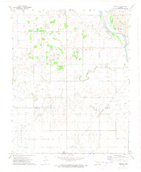
The Ringwood Oil Field dominates this 1960s landscape, where oil and gas wells are densely distributed across the plains of Major County. This industrial development is punctuated by localized agricultural and community landmarks, such as New Hope Ch and the Swiggart Cem. Transportation is defined by the heavy rail infrastructure of the Chicago Rock Island and Pacific railroad, which skirts a Refinery and a Water Tank as it moves through the northeast corner.
Find a feature on this map
25 named features on this map. Tap any name to fly to it.
Don’t see what you’re looking for? This feature index may not catch every label — zoom into the map to look around manually.
Map Details
Editions of this 1969 Fairview SE Map
This is the sole edition of this map. No revisions or reprints were ever made.
Other maps of this area

1893 · Ames
USGS Topo · 1:62,500

1955 · Woodward
USGS Topo · 1:250,000

1956 · Ames
USGS Topo · 1:62,500

1956 · Ringwood
USGS Topo · 1:62,500

1958 · Woodward
USGS Topo · 1:250,000

1969 · Fairview NE
USGS Topo · 1:24,000

1969 · Fairview
USGS Topo · 1:24,000

1969 · Cleo Springs
USGS Topo · 1:24,000

1972 · Homestead
USGS Topo · 1:24,000
1972 · Isabella
USGS Topo · 1:24,000