
1972 Map of Homestead
USGS Topo · Published 1974About this map
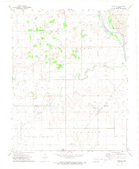
The transition between Major County and Blaine County is defined by a landscape of agricultural tradition and energy production during the early 1970s. The settlement of Homestead serves as a local focal point near the Chicago Rock Island and Pacific tracks, while the northern edge of the map reaches the Fairview corporate boundary and the Atchison Topeka and Santa Fe railroad. This survey captures a rural community structured around local institutions like the Progressive School and Mennonite Church, alongside several family and community burial grounds including Plymuth Cemetery and Cedar Cemetery. The terrain is deeply marked by the hydrology of Sand Creek and Deep Creek, as well as an extensive network of natural gas infrastructure indicated by numerous gas wells scattered across the township sections.
Find a feature on this map
18 named features on this map. Tap any name to fly to it.
Don’t see what you’re looking for? This feature index may not catch every label — zoom into the map to look around manually.
Map Details
Editions of this 1972 Homestead Map
This is the sole edition of this map. No revisions or reprints were ever made.
Other maps of this area

1955 · Woodward
USGS Topo · 1:250,000

1958 · Woodward
USGS Topo · 1:250,000

1969 · Glass Mountains
USGS Topo · 1:24,000

1969 · Fairview SE
USGS Topo · 1:24,000

1969 · Fairview
USGS Topo · 1:24,000

1972 · Longdale
USGS Topo · 1:24,000

1972 · Canton
USGS Topo · 1:24,000

1972 · Southard
USGS Topo · 1:24,000

1972 · Okeene
USGS Topo · 1:24,000
1972 · Isabella
USGS Topo · 1:24,000