
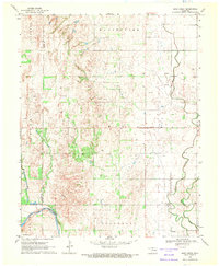
1969 Map of Nash
USGS Topo · Published 1971About this map
The town of Nash serves as the central hub of this north-central Oklahoma landscape, situated where the Atchison Topeka and Santa Fe railroad cuts across the prairie. The geography is defined by the braided path of the Salt Fork Arkansas River, which creates a complex hydrologic network alongside Wagon Creek and Coldwater Creek. To the northwest, the presence of Kegelman Auxiliary Field (Vance Air Force Base) introduces a significant military footprint to this otherwise agricultural region.
Find a feature on this map
20 named features on this map. Tap any name to fly to it.
Don’t see what you’re looking for? This feature index may not catch every label — zoom into the map to look around manually.
Map Details
Editions of this 1969 Nash Map
This is the sole edition of this map. No revisions or reprints were ever made.
Other maps of this area

1955 · Enid
USGS Topo · 1:250,000

1955 · Woodward
USGS Topo · 1:250,000

1958 · Enid
USGS Topo · 1:250,000

1958 · Woodward
USGS Topo · 1:250,000

1968 · Hillsdale
USGS Topo · 1:24,000

1968 · Pond Creek NW
USGS Topo · 1:24,000

1968 · Wakita SW
USGS Topo · 1:24,000

1969 · Jet
USGS Topo · 1:24,000

1969 · Goltry
USGS Topo · 1:24,000
1969 · Sand Creek
USGS Topo · 1:24,000