
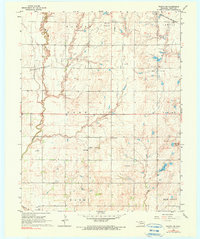
1968 Map of Wakita SW
USGS Topo · Published 1970About this map
Wakita Field Gas and Oil Trend and the Cherry Vale Oil and Gas Field define this rural Grant County landscape, showing the intensive energy extraction characteristic of northern Oklahoma in the late 1960s. The terrain is a mixture of agriculture and industry, where Oil Wells and Gas Wells sit alongside traditional landmarks like the Prairie Queen Ch and Gore Sch.
Find a feature on this map
26 named features on this map. Tap any name to fly to it.
Don’t see what you’re looking for? This feature index may not catch every label — zoom into the map to look around manually.
Map Details
Editions of this 1968 Wakita SW Map
2 editions found
Other maps of this area

1955 · Enid
USGS Topo · 1:250,000

1955 · Woodward
USGS Topo · 1:250,000

1958 · Enid
USGS Topo · 1:250,000

1958 · Woodward
USGS Topo · 1:250,000

1968 · Wakita
USGS Topo · 1:24,000

1968 · Wakita SE
USGS Topo · 1:24,000

1968 · Pond Creek
USGS Topo · 1:24,000

1968 · Pond Creek NW
USGS Topo · 1:24,000
1968 · Wakita NE
USGS Topo · 1:24,000
1969 · Manchester
USGS Topo · 1:24,000