
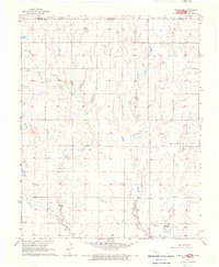
1968 Map of Wakita SE
USGS Topo · Published 1970About this map
Pond Creek and Osage Creek wind through the agricultural sections of Grant County, where the landscape is divided into townships including Jarvis, Medford, and Rock Island. The small settlement of Clyde serves as a central point in the northern half of the quadrangle, situated along the Atchison Topeka and Santa Fe railroad line. This rail-dependent layout is mirrored in the southeast, where the Chicago Rock Island and Pacific crosses through Liberty.
Find a feature on this map
22 named features on this map. Tap any name to fly to it.
Don’t see what you’re looking for? This feature index may not catch every label — zoom into the map to look around manually.
Map Details
Editions of this 1968 Wakita SE Map
This is the sole edition of this map. No revisions or reprints were ever made.
Other maps of this area

1955 · Enid
USGS Topo · 1:250,000

1958 · Enid
USGS Topo · 1:250,000

1968 · Lamont NW
USGS Topo · 1:24,000

1968 · Wakita
USGS Topo · 1:24,000

1968 · Renfrow
USGS Topo · 1:24,000

1968 · Medford
USGS Topo · 1:24,000

1968 · Pond Creek
USGS Topo · 1:24,000

1968 · Pond Creek NW
USGS Topo · 1:24,000
1968 · Wakita NE
USGS Topo · 1:24,000

1968 · Wakita SW
USGS Topo · 1:24,000