
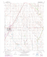
1968 Map of Medford
USGS Topo · Published 1970About this map
Medford serves as the focal point of this Grant County survey, where the intersecting lines of the Chicago Rock Island and Pacific and the Atchison Topeka and Santa Fe railroads define the local landscape. The map captures a well-organized agrarian community in the late 1960s, featuring infrastructure ranging from the Medford Municipal Airport to the Medford Golf Course. Significant for genealogists, the sheet documents four distinct burial grounds, including the Czecho Slovak Cem and Tureck Cem, reflecting the ethnic heritage of the northern Oklahoma plains.
Find a feature on this map
27 named features on this map. Tap any name to fly to it.
Don’t see what you’re looking for? This feature index may not catch every label — zoom into the map to look around manually.
Map Details
Editions of this 1968 Medford Map
2 editions found
Other maps of this area

1955 · Enid
USGS Topo · 1:250,000

1958 · Enid
USGS Topo · 1:250,000

1968 · Lamont NW
USGS Topo · 1:24,000

1968 · Deer Creek
USGS Topo · 1:24,000

1968 · Wakita SE
USGS Topo · 1:24,000

1968 · Renfrow
USGS Topo · 1:24,000

1968 · Lamont
USGS Topo · 1:24,000
1968 · Medford NE
USGS Topo · 1:24,000

1968 · Pond Creek
USGS Topo · 1:24,000
1968 · Wakita NE
USGS Topo · 1:24,000