
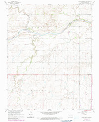
1968 Map of Pond Creek NW
USGS Topo · Published 1970About this map
The Salt Fork Arkansas River carves a wide path through this Grant County landscape, creating a distinct riparian corridor characterized by Rock Island and the meandering channels of Coldwater Creek. The settlement pattern reflects the late 1960s rural infrastructure of northern Oklahoma, anchored by the Riverdale Community Hall and the intersection at Four Corners. Small family and community landmarks are frequent, including the Friends Cem and Mt Zion Cem, providing vital geographic anchors for local genealogists. Evidence of regional transport and utility is visible at Hixon Bridge and the Biby Landing Strip near the northern border. The map also delineates the townships of Barr, Banner, and Berry, illustrating the formal land divisions that shaped the development of these prairie agricultural lands.
Find a feature on this map
15 named features on this map. Tap any name to fly to it.
Don’t see what you’re looking for? This feature index may not catch every label — zoom into the map to look around manually.
Map Details
Editions of this 1968 Pond Creek NW Map
2 editions found
Other maps of this area

1955 · Enid
USGS Topo · 1:250,000

1955 · Woodward
USGS Topo · 1:250,000

1958 · Enid
USGS Topo · 1:250,000

1958 · Woodward
USGS Topo · 1:250,000

1968 · Hillsdale
USGS Topo · 1:24,000

1968 · Wakita SE
USGS Topo · 1:24,000

1968 · Kremlin
USGS Topo · 1:24,000

1968 · Pond Creek
USGS Topo · 1:24,000

1968 · Wakita SW
USGS Topo · 1:24,000

1969 · Nash
USGS Topo · 1:24,000