
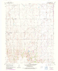
1968 Map of Hillsdale
USGS Topo · Published 1969About this map
Hillsdale serves as the primary hub of this north-central Oklahoma landscape, situated along the steel rails of the Atchison Topeka and Santa Fe railroad. The 1968 survey reveals a terrain defined by agricultural grid lines and the intricate erosion patterns of the Ninemile Canyons. Waterways like Ninemile Creek, Wild Horse Creek, and Sand Creek cut through the plains, shaping the local topography and drainage across several civil townships including Banner, Keokuk, and Kremlin.
Find a feature on this map
17 named features on this map. Tap any name to fly to it.
Don’t see what you’re looking for? This feature index may not catch every label — zoom into the map to look around manually.
Map Details
Editions of this 1968 Hillsdale Map
2 editions found
Other maps of this area

1955 · Enid West
USGS Topo · 1:24,000

1955 · Enid East
USGS Topo · 1:24,000

1955 · Enid
USGS Topo · 1:250,000

1955 · Woodward
USGS Topo · 1:250,000

1956 · Enid
USGS Topo · 1:62,500

1956 · Ringwood
USGS Topo · 1:62,500

1958 · Enid
USGS Topo · 1:250,000

1958 · Woodward
USGS Topo · 1:250,000

1968 · Kremlin
USGS Topo · 1:24,000

1968 · Pond Creek
USGS Topo · 1:24,000