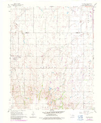
1968 Map of Hillsdale
USGS Topo · Published 1983About this map
Hillsdale serves as the primary settlement on this North Central Oklahoma landscape, situated at a junction where the Atchison Topeka And Santa Fe railway cuts through the plains of Garfield County. The town is flanked by a local Reservoir and the Hillsdale Cem, while the surrounding terrain is defined by the drainage basins of Sand Creek, Ninemile Creek, and Wild Horse Creek. A notable topographical feature is Ninemile Canyon, which provides a break in the otherwise steady agricultural grid of the Keowee and Banner townships. Evidence of mid-century infrastructure and industrial development is visible through a remote Landing Strip in the east and a Radio Tower to the south, alongside an identified Oil Well near the border of North Enid. Purple photo-revisions from the early 1980s document changes in fence lines and field boundaries over several decades of rural land use.
Find a feature on this map
17 named features on this map. Tap any name to fly to it.
Don’t see what you’re looking for? This feature index may not catch every label — zoom into the map to look around manually.
Map Details
Editions of this 1968 Hillsdale Map
2 editions found
Other maps of this area

1955 · Enid West
USGS Topo · 1:24,000

1955 · Enid East
USGS Topo · 1:24,000

1955 · Enid
USGS Topo · 1:250,000

1955 · Woodward
USGS Topo · 1:250,000

1956 · Enid
USGS Topo · 1:62,500

1956 · Ringwood
USGS Topo · 1:62,500

1958 · Enid
USGS Topo · 1:250,000

1958 · Woodward
USGS Topo · 1:250,000

1968 · Hillsdale
USGS Topo · 1:24,000

1968 · Kremlin
USGS Topo · 1:24,000