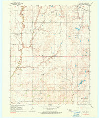
1968 Map of Wakita SW
USGS Topo · Published 1990About this map
Oil and gas development defines the landscape of this Grant County region, where the Wakita Field and Cherokee Trend Oil and Gas Field intersect. Numerous extraction points like Oil Well and Gas Well are interspersed among the section lines, suggesting an era of significant energy production that transformed traditional farming tracts. The industrial footprint is further evidenced by a Pumping Station and Radio Tower, while the Atchison Topeka and Santa Fe railroad provides the primary transportation corridor through the north.
Find a feature on this map
24 named features on this map. Tap any name to fly to it.
Don’t see what you’re looking for? This feature index may not catch every label — zoom into the map to look around manually.
Map Details
Editions of this 1968 Wakita SW Map
2 editions found
Other maps of this area

1955 · Enid
USGS Topo · 1:250,000

1955 · Woodward
USGS Topo · 1:250,000

1958 · Enid
USGS Topo · 1:250,000

1958 · Woodward
USGS Topo · 1:250,000

1968 · Wakita
USGS Topo · 1:24,000

1968 · Wakita SE
USGS Topo · 1:24,000

1968 · Pond Creek
USGS Topo · 1:24,000

1968 · Pond Creek NW
USGS Topo · 1:24,000
1968 · Wakita NE
USGS Topo · 1:24,000

1968 · Wakita SW
USGS Topo · 1:24,000