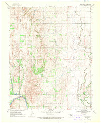
1969 Map of Sand Creek
USGS Topo · Published 1971About this map
The Salt Fork Arkansas River cuts through the southwestern corner of this Oklahoma landscape, defined by the transition from the Manchester Oil and Gas Field to the rolling agricultural plains of Grant and Alfalfa counties. By the late 1960s, the area was heavily punctuated by industrial activity, with numerous Gas Wells and Oil Wells scattered across the townships of Manchester and Wakita. Evidence of the rural community structure remains prominent, from the Substation in the north to the Community Center further south.
Find a feature on this map
23 named features on this map. Tap any name to fly to it.
Don’t see what you’re looking for? This feature index may not catch every label — zoom into the map to look around manually.
Map Details
Editions of this 1969 Sand Creek Map
This is the sole edition of this map. No revisions or reprints were ever made.
Other maps of this area

1955 · Enid
USGS Topo · 1:250,000

1955 · Woodward
USGS Topo · 1:250,000

1958 · Enid
USGS Topo · 1:250,000

1958 · Woodward
USGS Topo · 1:250,000

1968 · Wakita
USGS Topo · 1:24,000

1968 · Pond Creek NW
USGS Topo · 1:24,000

1968 · Wakita SW
USGS Topo · 1:24,000

1969 · Jet
USGS Topo · 1:24,000
1969 · Manchester
USGS Topo · 1:24,000

1969 · Nash
USGS Topo · 1:24,000