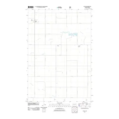
2011 Map of Golva
USGS Topo · Published 2011About this map
Golva sits at the heart of this Western North Dakota landscape, a small settlement defined by its grid of local roads and the drainages that cross the prairie. The town is flanked to the northwest by Saint Marys Cemetery, while the rural expanse to the south and east is punctuated by landmarks such as Burkey Cemetery and the Finneman Private Field. Water features are central to the terrain, most notably Bosserman Lake and the winding courses of Bullion Creek and Williams Creek. The transportation network is a strict section-line grid, including Marmarth Rd and Pipeline Rd, reflecting the highly organized agricultural and industrial divisions of Golden Valley County. This survey captures the region as a stable ranching and farming community, where isolated cemeteries and private airfields mark the sparse but enduring human presence across the high plains.
Find a feature on this map
23 named features on this map. Tap any name to fly to it.
Don’t see what you’re looking for? This feature index may not catch every label — zoom into the map to look around manually.
Map Details
Editions of this 2011 Golva Map
This is the sole edition of this map. No revisions or reprints were ever made.
Other maps of this area

1953 · Miles City
USGS Topo · 1:250,000

1953 · Dickinson
USGS Topo · 1:250,000

1957 · Dickinson
USGS Topo · 1:250,000

1957 · Miles City
USGS Topo · 1:250,000

1958 · Miles City
USGS Topo · 1:250,000

1979 · Sentinel Butte SE
USGS Topo · 1:24,000

1979 · Three V Crossing
USGS Topo · 1:24,000

1980 · Golva
USGS Topo · 1:24,000

1980 · Thelan
USGS Topo · 1:24,000

1980 · Alpha
USGS Topo · 1:24,000