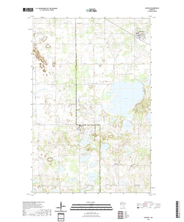
2022 Map of Gonvick
USGS Topo · Published 2022About this map
The settlement of Gonvick anchors this portion of northwestern Minnesota, situated along the Lost River near the northern boundary of the survey. The landscape is defined by its extensive wetland and lake systems, including the large expanse of Pine Lake and the smaller Little Pine Lake and Pike Lake to the south. This area, divided by the Polk Co Clearwater Co line, reflects a deep-rooted Scandinavian heritage, evidenced by the presence of several community spiritual centers. For genealogists, the map identifies specific local landmarks such as Samhold Lutheran Church in the north and the Bethlehem Lutheran Church and its associated Cem further south near Queen Township Cem. The rural community of Weme sits in the lower eastern quadrant, surrounded by smaller water bodies like Sand Lake and Mule John Lake, illustrating the sparse, water-interspersed settlement pattern of the region.
Find a feature on this map
65 named features on this map. Tap any name to fly to it.
Don’t see what you’re looking for? This feature index may not catch every label — zoom into the map to look around manually.
Map Details
Editions of this 2022 Gonvick Map
This is the sole edition of this map. No revisions or reprints were ever made.
Other maps of this area

1919 · Fosston
USGS Topo · 1:62,500

1919 · Churnes
USGS Topo · 1:62,500

1919 · Winsor
USGS Topo · 1:62,500

1943 · Bagley
USGS Topo · 1:62,500

1954 · Bemidji
USGS Topo · 1:250,000

1957 · Bemidji
USGS Topo · 1:250,000

1958 · Bemidji
USGS Topo · 1:250,000

1969 · Olga
USGS Topo · 1:24,000

1969 · Clearbrook
USGS Topo · 1:24,000

1969 · Fosston SE
USGS Topo · 1:24,000