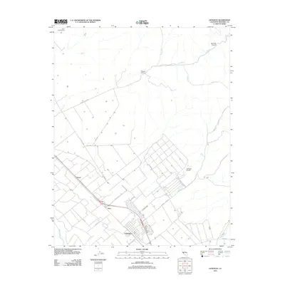
2012 Map of Gonzales
USGS Topo · Published 2012About this map
Gonzales serves as the central hub of this agricultural corridor, situated along the Salinas River in Monterey County. The landscape is defined by the sharp transition between the irrigated valley floor and the rising canyons to the east, including Chualar Canyon, Espinosa Canyon, and Johnson Canyon. This era shows a well-established transportation network, where Us 101 S parallels the river, connecting the main town with smaller outposts like Penvir and Dean. The map captures the sophisticated irrigation and access systems required for large-scale farming, indicated by a dense grid of local thoroughfares such as Old Stage Rd, Foletta Rd, and Associated Rd. From the Quail Creek Airport in the northwest to the remote reaches of McCoy Cr, the map documents the geographic intersection of industrial agriculture and the natural drainage of the Gabilan Range.
Find a feature on this map
33 named features on this map. Tap any name to fly to it.
Don’t see what you’re looking for? This feature index may not catch every label — zoom into the map to look around manually.
Map Details
Editions of this 2012 Gonzales Map
This is the sole edition of this map. No revisions or reprints were ever made.
Other maps of this area

1910 · Gonzales
USGS Topo · 1:31,680

1910 · Salinas
USGS Topo · 1:31,680

1910 · Soledad
USGS Topo · 1:31,680

1912 · Salinas
USGS Topo · 1:62,500

1915 · Soledad
USGS Topo · 1:62,500

1920 · Jamesburg
USGS Topo · 1:48,000

1921 · Jamesburg
USGS Topo · 1:62,500

1921 · Gonzales
USGS Topo · 1:62,500

1939 · Jamesburg
USGS Topo · 1:62,500

1940 · Salinas
USGS Topo · 1:62,500