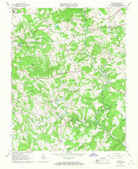
1965 Map of Goode
USGS Topo · Published 1967About this map
Big Otter River and the Little Otter River dominate this mid-century landscape in Bedford County, carving deep valleys through the Piedmont terrain. The Norfolk And Western railroad forms a primary corridor through the northern half of the sheet, connecting the rural communities of Goode, Lowry, and Centerville. This era shows a community in transition, where traditional country landmarks like Western Light Ch and Timber Ridge Ch exist alongside modern infrastructure such as a Sewage Disposal Pond and a Drive-in Theater near the northwestern corner.
Find a feature on this map
42 named features on this map. Tap any name to fly to it.
Don’t see what you’re looking for? This feature index may not catch every label — zoom into the map to look around manually.
Map Details
Editions of this 1965 Goode Map
4 editions found
Other maps of this area

1890 · Roanoke
USGS Topo · 1:125,000

1891 · Roanoke
USGS Topo · 1:125,000

1892 · Lynchburg
USGS Topo · 1:125,000

1947 · Roanoke
USGS Topo · 1:250,000

1950 · Goode
USGS Topo · 1:62,500

1950 · Peaks of Otter
USGS Topo · 1:62,500

1951 · Moneta
USGS Topo · 1:62,500

1951 · Altavista
USGS Topo · 1:62,500

1959 · Roanoke
USGS Topo · 1:250,000

1963 · Roanoke
USGS Topo · 1:250,000